Auckland to Taupō & Tongariro: The Central Plateau Run
Auckland to Taupō and Tongariro: drive times and routes, Lake Taupō's best stops, how to do the Tongariro Alpine Crossing in 2026, and where to stay.
This article contains advertising. Our booking links are routed through a partner that adds commission tracking automatically, so if you book through one we earn a commission from the provider, at no extra cost to you. It never affects what we recommend. Affiliate disclosure
Somewhere south of Tokoroa, after an hour of pine plantations, the road tips downhill and Lake Taupō appears ahead: a sheet of water so wide it looks like the sea, and on a clear day, three volcanoes floating above the far shore. It is one of the great arrival views in New Zealand, and it marks the start of the Central Plateau, the high volcanic heart of the North Island. A drive from Auckland to Taupō and on into Tongariro National Park takes you from the country’s biggest city to New Zealand’s largest lake and the Tongariro Alpine Crossing; allow four to five hours to reach the park.
This guide covers the whole Central Plateau run: the routes from Auckland and how long they take, what is worth doing around Lake Taupō, how to plan the Tongariro Alpine Crossing in 2026 — shuttles, bookings, timing and weather — and the other walks, towns and places to stay on the plateau. Prices and conditions were checked in October 2026; treat them as the right order of magnitude, and check the weather and the Department of Conservation’s track page before you commit to anything on the mountains.
At a glance: Auckland to Taupō and Tongariro
| Question | Answer |
|---|---|
| Auckland to Taupō | Roughly 270 km, about 3.5 hours |
| Auckland to Tūrangi | About 4 hours |
| Auckland to National Park village | About 4-5 hours |
| The Tongariro Alpine Crossing | 20.2 km one way, according to the shuttle operators; the Department of Conservation says allow 9 hours |
| Best season for the Crossing | Summer; from May to October it becomes an alpine trip needing winter skills |
| Minimum stay | 2 nights for the Crossing, with a spare day for weather |
| Fuel, Auckland to Taupō | About NZ$55-60 for a small car |
| Without a car | InterCity coaches to Taupō and Tūrangi; the Northern Explorer train to National Park |
Driving from Auckland to Taupō
The quickest way to drive from Auckland to Taupō is straight down State Highway 1: the Southern Motorway and the Waikato Expressway, which bypasses Hamilton and Cambridge, then the highway through Tīrau, Putāruru and Tokoroa. It takes about three and a half hours without stops, and the road is straightforward, with regular passing lanes. Our Auckland to Wellington road trip guide covers this stretch stop by stop, including Hamilton Gardens, Tīrau’s corrugated-iron dog and the Blue Spring near Putāruru.
There are two good alternatives:
- Via Rotorua. Leave State Highway 1 at Tīrau for State Highway 5 to Rotorua, then continue south to Taupō past Wai-O-Tapu and the geothermal valleys. It adds about half an hour of driving and is best with a night in Rotorua; our Auckland to Rotorua guide covers the first half.
- Via Waitomo and Taumarunui. If Tongariro National Park is your goal rather than Taupō, you can head south-west from Hamilton on State Highway 3 to Waitomo and Te Kūiti, then follow State Highway 4 through Taumarunui to National Park village. It takes about four and a half hours and passes the glowworm caves on the way.
Beat the Auckland traffic by leaving before seven in the morning or after the morning peak, and avoid Friday afternoons, particularly before long weekends and school holidays, when the whole southbound motorway slows to a crawl.
Without a car
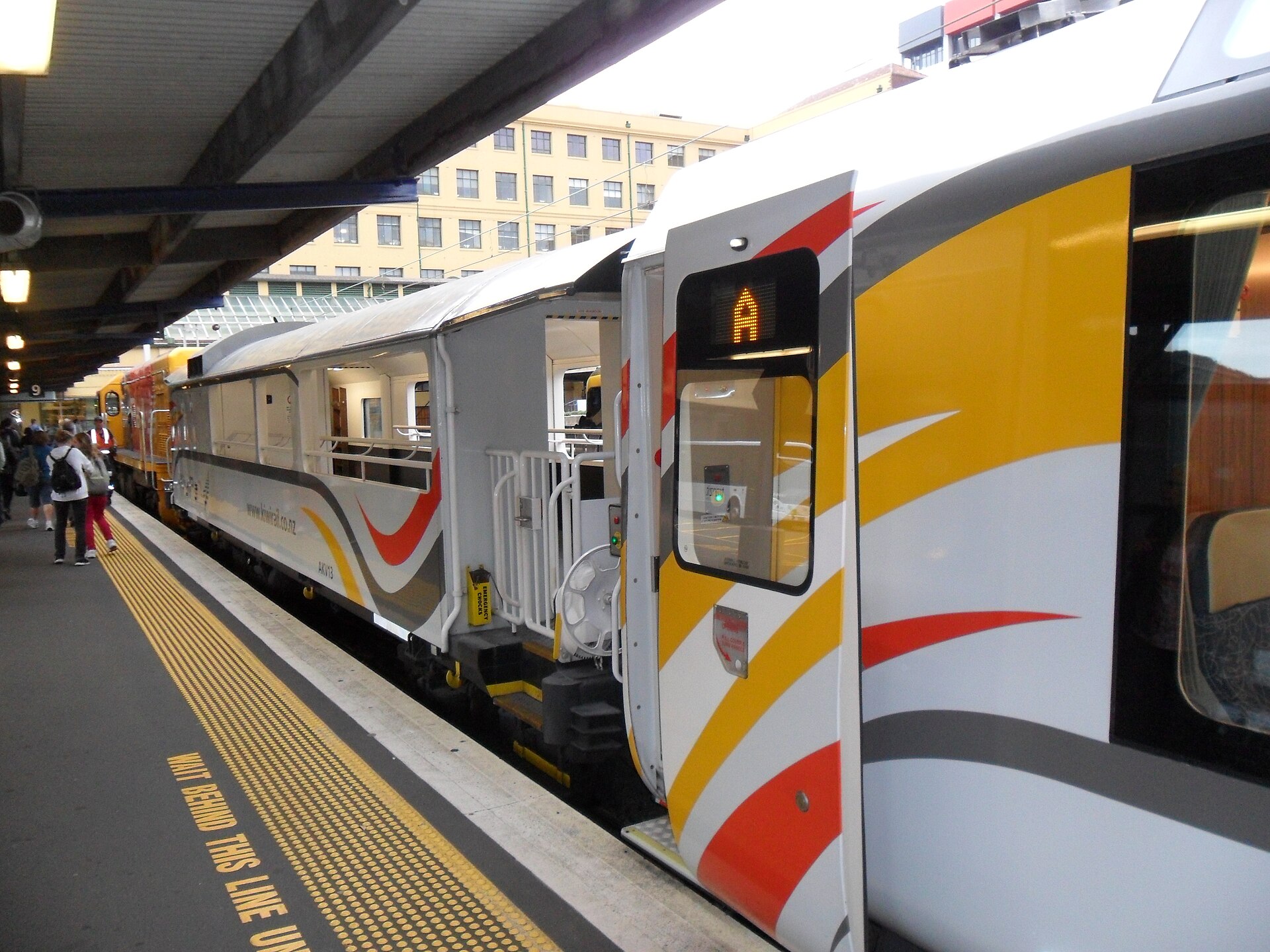
InterCity coaches run from Auckland to Taupō and Tūrangi, and some continue to National Park village. KiwiRail’s Northern Explorer train stops at National Park on its way south on Mondays, Thursdays and Saturdays, and north on Wednesdays, Fridays and Sundays; it is seated only and must be booked ahead. Crossing shuttles operate from National Park village, Taupō, Tūrangi, Ōhakune and Taumarunui, so the Crossing is entirely possible without a car if you plan the transport carefully.
Lake Taupō: what is worth doing
Lake Taupō is the largest lake in New Zealand, covering 616 square kilometres, and it fills the caldera of one of the most powerful volcanoes on earth, whose last great eruption, around 1,800 years ago, blanketed much of the North Island in ash. Today it is a calm, clear lake ringed with beaches, and the town of Taupō on its north-eastern shore is the Central Plateau’s main base.
Huka Falls and the Aratiatia Rapids
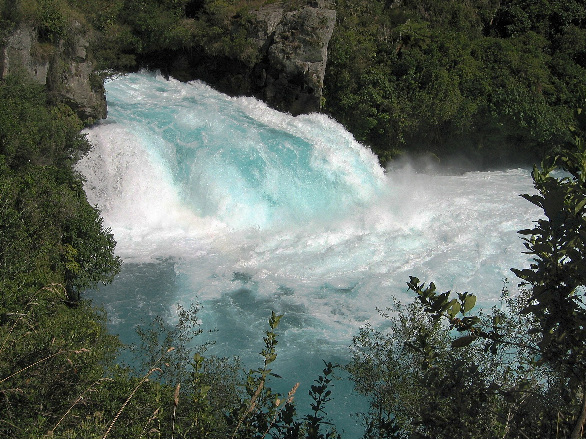
Just north of town, the whole Waikato River, the country’s longest, squeezes through a narrow rock chasm and bursts out over Huka Falls in a torrent of startlingly blue-white water. It is free, a minute’s walk from the car park, and more powerful than any photograph suggests. Jet boats run up the river to the base of the falls if you want to see it from below. A little downstream, the Aratiatia Rapids are dry most of the day, until the dam upstream releases water several times a day and the gorge floods in minutes; check the release times.
Hot water, free and otherwise
Taupō sits on a geothermal field, and the best thing about that is free. At Spa Park, a short drive or walk from town, the hot Otumuheke Stream tumbles into the cold Waikato River, and you can sit in the warm pools where the two meet. For something more organised, there are commercial hot pool complexes on the edge of town, and the geothermal walkway at Craters of the Moon, north of town, winds through steaming vents and craters for a small fee.
On and around the lake
- The Mine Bay rock carvings: a huge modern Māori carving on the cliffs of Mine Bay, reachable only by boat or kayak. The cruises from Taupō harbour are one of the most popular things to do in town.
- Skydiving: Taupō is one of the most popular places in the country to jump out of a plane, with the lake and the volcanoes below.
- Trout fishing: the lake and its rivers are famous for trout. The Taupō district has its own fishing licence, separate from the rest of the country, so buy the right one.
- Cycling: the Great Lake Trail runs through native bush and above the lake on the western side, with some of the best mountain biking in the North Island.
The honest verdict: Taupō is a pleasant, easy base rather than a thrilling destination. Huka Falls, Spa Park and a boat to the carvings fill a very good day. Beyond that, it is the lake and the mountains beyond it that make the trip.
Tongariro National Park
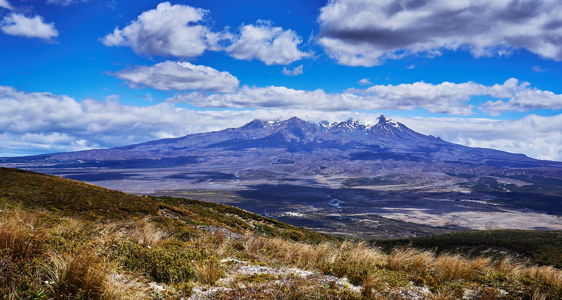
Tongariro National Park is New Zealand’s oldest national park, established in 1887 after the paramount chief of Ngāti Tūwharetoa, Horonuku Te Heuheu Tūkino IV, gifted the sacred peaks to the nation so that they would be protected. It is a dual World Heritage Site, recognised for both its volcanic landscape and its cultural importance. Three active volcanoes dominate it: Tongariro, the near-perfect cone of Ngauruhoe, and Ruapehu, the highest mountain in the North Island, with its ski fields and crater lake.
The park is about an hour’s drive south-west of Taupō, around the lake through Tūrangi. Four places work as a base:
- National Park village: small and practical, with motels, lodges and the Crossing shuttles on the doorstep.
- Whakapapa Village: inside the park on the slopes of Ruapehu, with the visitor centre and several short walks from the door, but very little accommodation.
- Ōhakune: the southern gateway to the park, with a giant carrot sculpture and the Old Coach Road, a walking and mountain-bike track.
- Tūrangi: on the southern shore of Lake Taupō, quieter, with trout fishing on the Tongariro River and shuttles to the Crossing.
The Tongariro Alpine Crossing in 2026
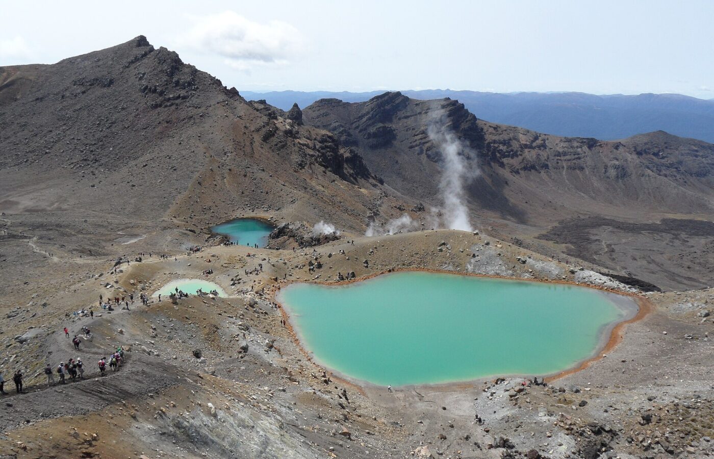
The Tongariro Alpine Crossing is often called the best one-day walk in New Zealand, and on a clear day it is hard to argue. The track runs 20.2 km one way, according to the shuttle operators, from the Mangatepōpō Valley at about 1,120 metres, up past the cone of Ngauruhoe to the Red Crater, the highest point at about 1,886 metres, then down past the vivid Emerald Lakes and the Blue Lake before a long descent through tussock and bush to the Ketetahi road end at about 760 metres. The Department of Conservation advises allowing nine hours.
How it works now
- Book. The Department of Conservation recommends that everyone walking the Crossing books, and booking is required if you are using a shuttle or a guide. Booking itself is free.
- Take a shuttle. In summer there is no parking for Crossing walkers at the Mangatepōpō car park, and a private car park operates near the Ketetahi end. Shuttles run from National Park village, Taupō, Tūrangi, Ōhakune and Taumarunui; one of the main operators charges about NZ$78 a person in 2026 for secure parking at the finish and a ride to the start. Prices vary between operators, so compare.
- Carry water and layers. There is no drinkable water on the track, so carry two to three litres. There are toilets every one to two hours. The weather on the ridges can turn from warm sunshine to freezing wind in minutes, even in summer.
- Watch the forecast, not the calendar. In cloud you will see nothing, and in strong wind the exposed ridges are dangerous. Shuttle operators will not run in bad conditions. This is why you need a spare day.
- Remember it is a volcano. The track crosses an active volcanic area. Eruptions are unlikely but possible at any time, and steam vents along the way must be avoided.
- Winter is different. From May to October, snow, ice and avalanche risk make the Crossing an alpine trip that needs winter skills and equipment. Unless you have them, go with a guide.
Coming changes. The government has announced plans to charge international visitors roughly NZ$20-40 each to walk the Crossing, along with a handful of other famous sites such as Cathedral Cove and Milford Sound, probably from late 2027. The details are still being worked out, and it will stay free for New Zealanders. Until then, walking the track itself is free.
The honest verdict: in good weather, with reasonable fitness, proper boots and a warm layer, it is one of the finest days out anywhere in the world. It is also long, steep in places, crowded at the popular viewpoints in summer, and genuinely serious in bad weather. If you are not a regular walker, or the forecast is poor, the shorter walks below will give you a far better day than a miserable slog.
What Crossing day actually looks like
- Early start. Shuttles typically collect walkers from the early morning, and most people start walking from the Mangatepōpō road end between about seven and nine.
- The valley. The first hour or so is a gentle climb up the Mangatepōpō Valley on boardwalk and gravel, past old lava flows, to the turn-off for Soda Springs, a short side trip to a small spring. Toilets are spaced along the track, roughly every one to two hours of walking.
- The Devil’s Staircase. Then comes the hard part: a long, steep climb up steps and rock to the flat floor of South Crater, with Ngauruhoe towering to one side. Take it slowly; there is a lot of day left.
- Red Crater. A second climb along an exposed ridge leads to the highest point, beside the rust-red walls of the Red Crater. This is where the wind bites and the weather matters most.
- The Emerald Lakes. The descent to the lakes is on loose volcanic scoria, and it is the part most people find hardest on the legs. At the bottom, the lakes themselves are vivid green and smell faintly of sulphur. This is the classic place to stop for lunch.
- Blue Lake and the long way down. The track crosses the Central Crater to the Blue Lake, a sacred lake where you should not eat or swim, then zigzags down past views of Lake Taupō, through tussock and finally native forest to the Ketetahi road end and your shuttle. The descent is long, and many walkers find it tougher than the climb.
What to take
- Proper walking boots or trail shoes with good grip, not fashion trainers.
- Layers: a warm mid-layer, a windproof and waterproof jacket, and a hat and gloves, even on a hot summer morning.
- Sunscreen and sunglasses; the sun at altitude burns quickly.
- Two to three litres of water, lunch and plenty of snacks.
- A charged phone, knowing that coverage is patchy, and a basic first-aid kit.
- Walking poles, if you use them, for the scoria descent.
Our packing list covers the rest of a New Zealand trip, and the weather guide explains how changeable the country’s weather can be.
Can you do the Tongariro Crossing as a day trip from Auckland?
No, not sensibly. It is four to four and a half hours’ drive each way, and the walk itself takes most of the daylight hours. Tours that promise the Tongariro Crossing from Auckland in a day mean a pre-dawn start, a nine-hour walk and a late-night return, and they cannot adapt to the weather. Plan at least two nights on the plateau: arrive the day before, walk on the best day, and keep the other in reserve.
Other walks and rides on the plateau
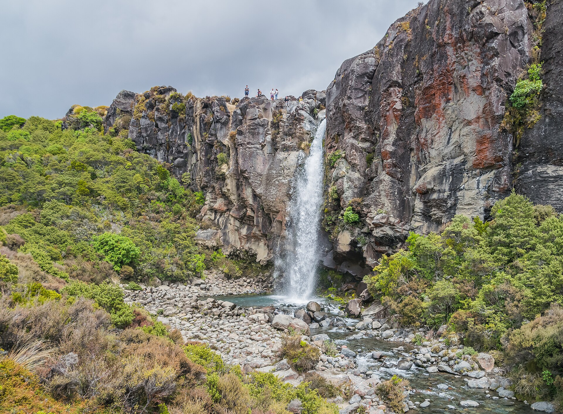
- Taranaki Falls: a two-hour loop from Whakapapa Village through tussock and beech forest to a 20-metre waterfall pouring over the edge of an old lava flow. The best short walk in the park.
- Silica Rapids: a loop of about two and a half hours from Whakapapa to a stream coloured creamy white by mineral deposits.
- Tama Lakes: a longer walk, most of a day, beyond Taranaki Falls to two crater lakes on the saddle between Ruapehu and Ngauruhoe, with big views of both.
- Lake Rotopounamu: a gentle loop through forest around a small lake near Tūrangi, and a good option when the tops are in cloud.
- The Tongariro Northern Circuit: one of New Zealand’s Great Walks, a three- to four-day loop around Ngauruhoe that includes the best of the Crossing. The huts must be booked in the Great Walks season.
- The Old Coach Road: a cycle trail from Ōhakune to Horopito along an old coach route, over historic rail viaducts and through native forest. Bikes can be hired in Ōhakune.
Tūrangi and the southern shore
Tūrangi is quieter than Taupō and handier for the Crossing. The Tongariro River, which runs through the town, is one of the most famous trout rivers in the world, and the Tongariro National Trout Centre just south of town shows how the fishery works. Nearby, the Tokaanu thermal pools are a simple, old-fashioned place for a hot soak after a day on the mountains. It is also the start of the Desert Road, which runs south from here to Waiouru; if you are heading on to Wellington, see our Auckland to Wellington road trip guide.
How long to stay: sample plans
| Time | Plan |
|---|---|
| 2 nights | Drive to Taupō via Huka Falls; next day, the Crossing by shuttle from Taupō or Tūrangi; back to Auckland or onward on day 3. No spare day for weather, so treat the Crossing as a bonus. |
| 3 nights | One night in Taupō, two in National Park village or Ōhakune: the Crossing on the best day, Taranaki Falls or the Old Coach Road on the other. |
| 4-5 nights | Taupō and the lake, then the park, adding Tama Lakes, Lake Rotopounamu and a soak at Tokaanu, or the Tongariro Northern Circuit. |
If the Central Plateau is part of a longer trip, our North Island road trip guide fits it into seven-, ten- and fourteen-day routes from Auckland.
Where to stay
| Base | Best for | Good to know |
|---|---|---|
| Taupō | The lake, restaurants and the most choice | About an hour from the Crossing; most shuttles run from here |
| Tūrangi | A quieter lake base, fishing, and a shorter shuttle to the Crossing | Limited dining |
| National Park village | Being closest to the Crossing | Small and basic; fills on good-weather weekends |
| Whakapapa Village | Walking straight out of the door into the park | Very little accommodation |
| Ōhakune | Restaurants, cycling, and the ski fields in winter | Skiing in winter and alpine activities in summer |
The kinds of accommodation on offer differ from town to town, so check what your chosen base has. In summer, and on any weekend when the forecast is good, book the nights around your Crossing day early.
Winter on the Central Plateau
From June to September, the plateau changes character. Ruapehu’s ski fields open, Ōhakune and National Park village fill with skiers, and prices rise accordingly. The Crossing becomes a winter mountaineering trip that most visitors should only attempt with a guide. The Desert Road section of State Highway 1 regularly closes in snow and ice, and other roads around the mountain can close too, so check the NZ Transport Agency journey planner every morning, carry warm clothes and food, and build a spare day into any plan that depends on driving over the plateau.
Driving tips for the plateau
- Do not drive here on arrival day. Four hours on unfamiliar roads after a long-haul flight is a bad idea; our first-day plan explains why, and what to do instead.
- Fill up in Taupō or Tūrangi. Fuel is scarce around the park and across the Desert Road.
- Expect weather. The villages around the park sit high — National Park village is at about 800 metres and Whakapapa higher still — and conditions can be very different from Auckland’s, with fog, ice and snow in winter and strong wind at any time of year.
- Watch for trucks. State Highway 1 is a major freight route, so expect heavy vehicles.
- Know the rules. Keep left, give way as signed and pull over for queues. Our driving guide covers the essentials.
With children
The Crossing is a long, hard day, and it suits only older children who are used to walking long distances. For families, the plateau is better enjoyed in smaller pieces: Huka Falls and the free hot pools at Spa Park in Taupō, the Taranaki Falls loop and the easy walk around Lake Rotopounamu, and the Old Coach Road on bikes. Every child under seven must travel in an approved child restraint, and rental companies hire seats by the day.
What it costs
| Item | Rough cost (NZ$) |
|---|---|
| Fuel, Auckland to Taupō | 55-60 one way for a small car |
| Fuel, Auckland to National Park village | 65-75 one way for a small car |
| Crossing shuttle and parking | About 78 per person with one main operator; compare |
| Walking the Crossing | Free until the planned international visitor fee arrives, probably from late 2027 |
| Holiday park cabin | About 95-185 a night |
| Compact hire car | About 45-120 a day, off-peak to peak |
For the costs of a longer road trip, and how a campervan compares, see our road trips from Auckland guide.
Frequently asked questions
How far is Taupō from Auckland?
Roughly 270 km by road, which takes around three and a half hours via State Highway 1, bypassing Hamilton and then running through Tīrau and Tokoroa. Going via Rotorua adds about half an hour.
How long does it take to drive from Auckland to Tongariro National Park?
About four to four and a half hours to National Park village or Whakapapa, either via Taupō and Tūrangi or via Waitomo and Taumarunui.
Can you do the Tongariro Alpine Crossing as a day trip from Auckland?
Not sensibly. The drive is four hours or more each way and the walk takes around nine hours. Stay at least two nights on the plateau so you can wait for good weather.
Do you need to book the Tongariro Alpine Crossing?
The Department of Conservation recommends booking for everyone, and booking is required if you use a shuttle or a guided walk. Booking is free. The planned fee for international visitors is not expected before late 2027.
Where should I stay for the Tongariro Crossing?
National Park village is closest to the start, with shuttles on the doorstep. Tūrangi and Ōhakune are good alternatives with more places to eat, and Taupō works too, about an hour away.
How long does the Tongariro Alpine Crossing take?
The Department of Conservation advises allowing nine hours for the walk, which the shuttle operators measure at 20.2 km. Fit walkers often take less, but allow the full time, especially if you want to stop at the Emerald Lakes.
When is the best time to do the Tongariro Crossing?
Summer and early autumn, roughly from November to April, on a clear, calm day. From May to October it becomes an alpine walk with snow, ice and avalanche risk, best done with a guide.
Is there a bus from Auckland to Taupō?
Yes. InterCity runs coaches from Auckland to Taupō and Tūrangi, some continuing to National Park village. The Northern Explorer train also stops at National Park village on selected days.
Related Auckland Guides
- Road Trips and Onward Travel from Auckland
- North Island Road Trip from Auckland
- Auckland to Wellington Road Trip
- Auckland to Rotorua: Drive Time and Stops
- Car Rental in Auckland
- Auckland’s Best Hikes and Walking Trails
- Auckland Packing List
Photo Credits
The Emerald Lakes, Tongariro Alpine Crossing: Emerald-Lakes by Follash, CC BY-SA 4.0, via Wikimedia Commons.
Huka Falls, Taupō: Huka Falls by Avenue, CC BY-SA 3.0, via Wikimedia Commons.
Mount Ruapehu from the Central Plateau: Mount Ruapehu (52696522797) by Geoff McKay from Palmerston North, New Zealand, CC BY 2.0, via Wikimedia Commons.
Taranaki Falls, Tongariro National Park: Taranaki Falls 12 by Krzysztof Golik, CC BY-SA 4.0, via Wikimedia Commons.