Waitakere Ranges Hikes: 12 Best Walks (2026)
Complete 2026 Waitakere Ranges hikes guide — 12 best walks from easy Kitekite Falls to the 75km Hillary Trail. Kauri dieback rules, family-friendly options.
This article contains advertising. Our booking links are routed through a partner that adds commission tracking automatically, so if you book through one we earn a commission from the provider, at no extra cost to you. It never affects what we recommend. Affiliate disclosure
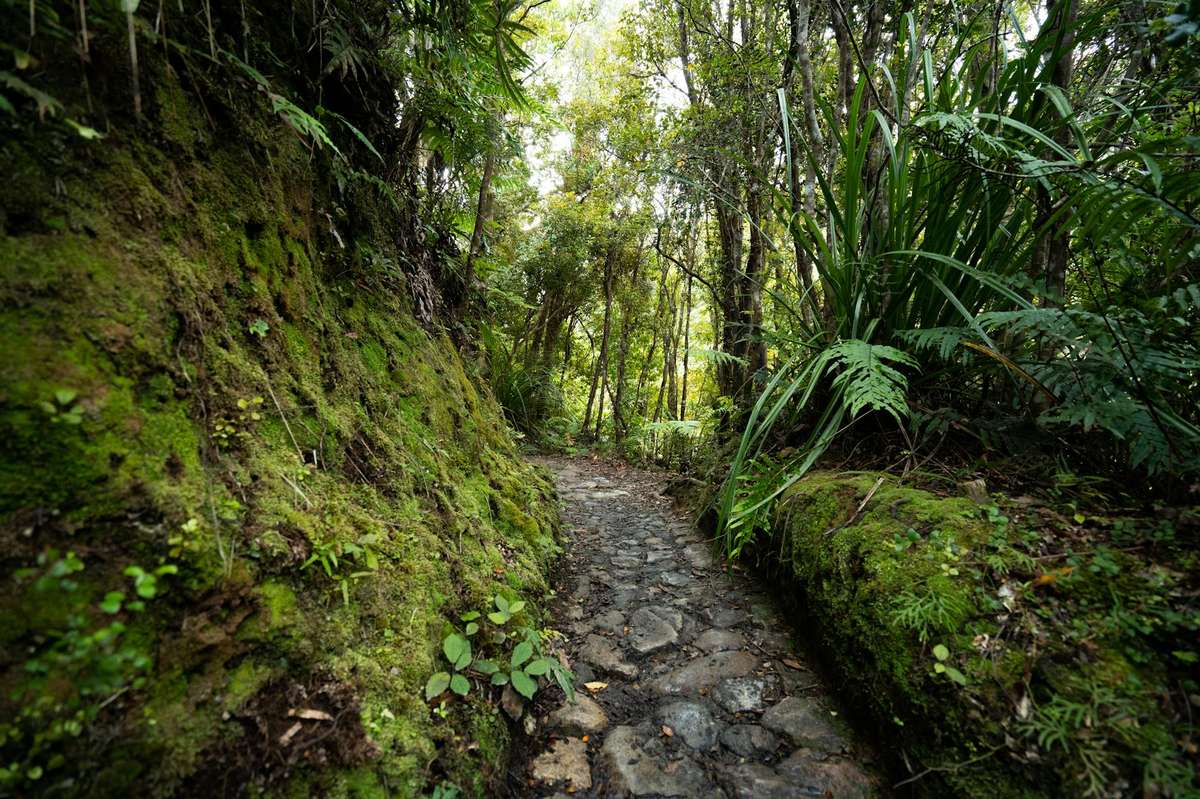
Waitākere Ranges hikes are some of NZ’s most accessible native bush walking trails — 16,000 hectares of regional park 30 minutes from Auckland CBD, with ancient kauri trees, dramatic waterfalls, west coast clifftop walks, and the multi-day 75km Hillary Trail. From the easy 1-hour Kitekite Falls walk at Piha to the demanding multi-day Hillary Trail traverse, the Waitākere Ranges offer hiking for every fitness level. This complete 2026 Waitākere Ranges hikes guide covers the best walks, kauri dieback rules, what to bring, and how to plan a perfect hiking day. Our Hunua Ranges hikes guide covers this in more depth.
Read this before anything else. The Waitākere track network is a moving target and has been since 2017. Kauri dieback closed large sections, then the January 2023 floods and Cyclone Gabrielle took out bridges and whole hillsides, and a fire damaged part of Fairy Falls in late 2025. Auckland Council has reopened around 97 kilometres of track and is still rebuilding, so some walks below are open, some half open, and one or two have been closed for years. Check the council’s regional parks page the morning you go, because tracks also close temporarily after heavy rain.
| Detail | What to know |
|---|---|
| Where to check status | Auckland Council regional parks pages, or ring the Arataki rangers on 09 892 4777 |
| Drive from the CBD | 30 minutes to Arataki, 45-50 to Piha, Karekare or Bethells. No public transport |
Why the Waitākere Ranges Are Special
- 16,000 hectares of regional park — one of Auckland’s largest reserves
- 30 mins from Auckland CBD — easy day-trip access
- Native NZ rainforest with kauri, rimu, totara, kahikatea
- Dramatic west coast clifftop walks — Tasman Sea views above Auckland’s wildest beaches
- Multiple waterfalls including iconic Kitekite Falls
- Auckland’s only multi-day hike — the 75km Hillary Trail
- Family-friendly options — short walks suitable for kids
Important: Kauri Dieback Rules
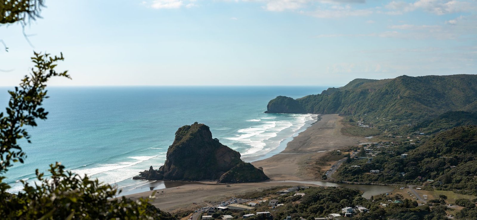
Many Waitākere Ranges tracks have been closed in recent years to prevent the spread of kauri dieback disease (Phytophthora agathidicida). The disease is fatal to NZ’s iconic kauri trees and is spread by foot traffic and dirty equipment.
Critical kauri dieback rules:
- Check Auckland Council’s Tracks & Walks page for current open tracks before visiting
- Use boot-cleaning stations at all trailheads — non-negotiable
- Stay on marked tracks — never cut corners
- Don’t bring muddy or unwashed boots from other regions
- Don’t take soil, plants, or seedlings off-track
Kauri are some of NZ’s most ancient and culturally significant trees. The 5-minute boot-clean ritual at trailheads is essential. Some classic tracks are still closed; check before driving out.
Track Status: What Is Open in 2026
This reflects Auckland Council and DOC information at the time of writing, in the middle of 2026. It will change, so treat it as a starting point rather than gospel — but it should save you the specific misery of driving 50 minutes to a locked gate.
| Track | Status at the time of writing |
|---|---|
| Kitekite Falls, Piha | Open to the falls, out and back. The Kitekite-Knutzen loop is not. Temporary closures after heavy rain |
| Knutzen Track, Piha | Closed. Two replacement bridges are being installed after the 2023 flood |
| Tasman Lookout Track, Piha | Closed since 2023 with three major slips. The Gap is reachable along the beach at low tide, with care |
| Lion Rock summit, Piha | Closed indefinitely. The rock is unstable and fencing is going in |
| Lake Wainamu, Bethells | Open from the Bethells Road car park to the lake. The 6.9km loop is closed, with a reopening signalled |
| Zion Hill loop, Karekare | Reopened in 2026 after nine years closed. Around 4.5 hours |
| Kuataika and Smyth Ridge, Anawhata | Both reopened in 2026 after major upgrades |
| Mercer Bay Loop, Comans, Ahuahu, Pararaha Valley | Open |
| Fairy Falls | Partly open after the 2025 fire. Upper platform open, lower section closed |
| Goldie Bush and Mokoroa Falls | Closed since 2020 for kauri protection |
| Te Henga Walkway | Two out-and-back sections only. The middle, between Tirikohua Point and Bethells, is gone |
How to Clean Your Boots Properly
Most people do this wrong, which is worse than useless because it makes you feel you have complied. The pathogen travels in soil, and a pinhead of dirt carries enough to infect a tree. The order matters.
- Scrub first, spray second. Disinfectant does nothing through a layer of mud. Get the soles, the welt and the tread pattern visibly clean before you touch the spray.
- Do it on the way in and on the way out. Both directions, every station, every time.
- Include everything that touches the ground: poles, dog leads, tripod feet, buggy wheels, a toddler’s shoes.
- Stay on the formed track, even where the mud looks worse in the middle. Walking around a puddle spreads soil sideways into the root zone.
The 12 Best Waitākere Ranges Hikes 2026
1. Kitekite Falls Track (Piha)

The Waitākere Ranges’ most rewarding short walk. 2.4km return through native bush to a 40m multi-tiered waterfall. Easy gravel track, family-friendly. Allow 1 hour. Trailhead at Glen Esk Road, Piha.
Since the 2023 floods this is an out-and-back rather than the old loop: the Knutzen side is closed while two replacement bridges go in. Access to the falls has been restored, but the council still closes it temporarily after heavy rain. The Glen Esk Road car park is small and fills by 10am on a fine weekend. The rocks around the swimming hole are genuinely slippery. See our Piha Beach guide for the rest of the day.
2. Karekare Falls Track
15-minute return walk through native bush to 30m Karekare Falls. Family-friendly. Combine with iconic Karekare Beach.
The shortest genuine waterfall walk in the ranges. It leaves the Karekare car park, which also serves the beach and the Pōhutukawa Glade, so one stop covers three walks. Karekare is quieter than Piha because there is no shop, no cafe and no patrol outside summer weekends. Our Karekare Beach guide covers the beach itself.
3. Te Henga Walkway
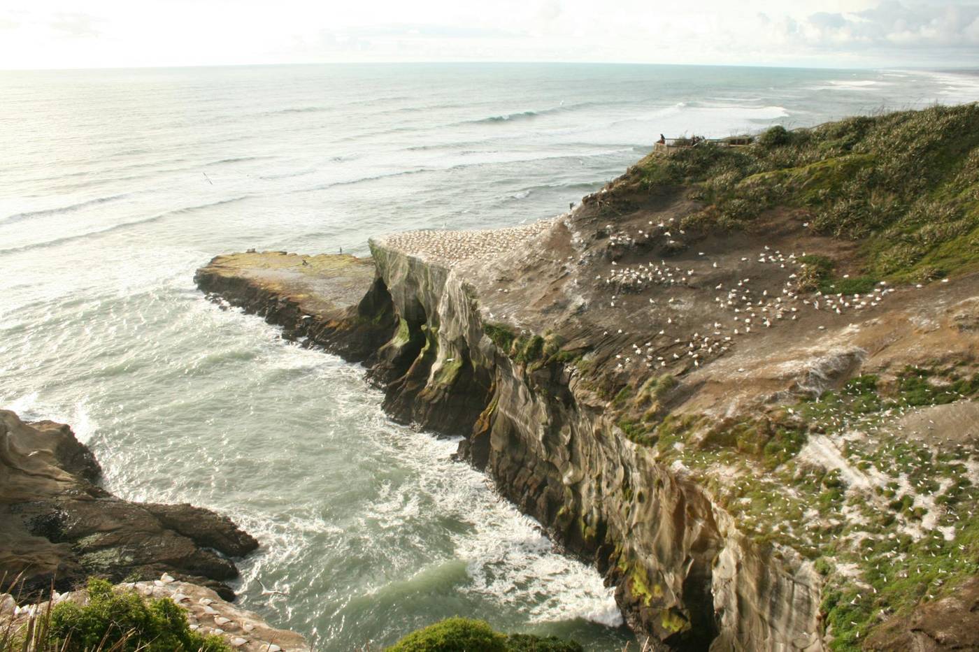
8km coastal clifftop walk from Bethells (Te Henga) Beach to Muriwai. Spectacular Tasman Sea views, native bush sections, gannet colony at Muriwai end. 4 hours one-way; arrange shuttle for return.
This needs correcting, because plenty of listings still describe it as a through-walk. It is not. Landslides in early 2023 destroyed the cliff sections between Tirikohua Point and Bethells, and DOC, which manages this track rather than Auckland Council, says the middle is inaccessible. Do one of two out-and-backs instead: Constable Road at Muriwai out to Tirikohua Point, roughly 3.6km return, or Bethells Road out to O’Neill Bay and Raetahinga Point, around 4km return. Both are exposed clifftop walking on private farmland. Our Bethells Beach guide has the southern access.
4. Hillary Trail
Auckland’s premier multi-day hike. 75km along the Waitākere Ranges from Arataki Visitor Centre (Titirangi) to Muriwai Beach. Named after Sir Edmund Hillary. 4-5 days with DOC huts and campsites along the route.
An important update: Auckland Council has stopped advertising the Hillary Trail as a multi-day walk while it works through the Waitākere Ranges track plan, and will update the route once that is finalised. In practice you cannot currently rely on an end-to-end 75km traverse — several linking sections are closed or under repair. What works is walking individual legs as day hikes with a car shuffle; Ōmanawanui and Karamatura at the southern end are open and superb.
Also worth correcting: the overnight sites along the route are Auckland Council regional park campgrounds, not DOC huts. Pararaha and Tunnel Point are tent-only, no-power backcountry sites booked through the council, and prices changed on 1 July 2026. Ring the rangers at Arataki on 09 892 4777 before planning anything longer than a day.
5. Mercer Bay Loop
1-hour clifftop loop near Karekare. Dramatic Tasman Sea views, sea cliffs, accessible. Easy walk family-friendly.
Open, and the best return on effort in the ranges: a mostly flat gravel loop along the top of high sea cliffs with views down to Karekare. It leaves from the small Log Race Road car park off Piha Road. Go late — this is the best sunset walk in Auckland — and note the cliff edges are unfenced in places, which matters with young children.
6. Comans Track (Karekare)
2-hour return ridge walk above Karekare. Dramatic views to the Tasman, native bush, less crowded than Piha tracks.
Open, and it links into the wider Karekare network, which is considerably more useful since the Zion Hill loop reopened. Comans climbs steadily and the ridge is exposed, so it is a poor choice in a westerly gale. Combined with a stretch of Zion Hill it makes a solid half day.
7. Goldie Bush Track (Muriwai)
2-hour return walk through native bush to Mokoroa Falls. Strong kauri hygiene rules. Less crowded than Piha-area tracks.
Strike this one off for now. Goldie Bush is a DOC scenic reserve rather than part of the regional park, and DOC formally closed its tracks in December 2020 to protect the kauri. It has not reopened, and both the Mokoroa Falls walk and the Goldie Bush loop sit inside that closure. For a waterfall in that part of the west, Fairy Falls is partly open again after the 2025 fire.
8. Pohutukawa Glade Walk (Karekare)
15-minute easy flat walk past giant pohutukawa trees. Family-friendly, suitable for prams.
Restored as part of the work that let the Zion Hill loop reopen, and the flattest walk in the ranges. It starts a short stroll from the Karekare car park and is the only track out here I would genuinely call pram-friendly — twenty minutes at toddler pace, gnarled pōhutukawa the whole way.
9. Te Ahuahu Track (Karekare)
2 hours return, climbs to a hilltop with 360° views over the west coast.
Listed by Auckland Council as Ahuahu Track and currently open. A proper climb rather than a stroll, with the whole coastline from Whatipu round to Te Henga as the reward. Grim in wind.
10. Tasman View Track
30-minute return clifftop walk with panoramic Tasman views. Quick and rewarding.
Closed, and has been since the 2023 storms. Three significant slips were identified on what the council calls the Tasman Lookout Track, and a geotechnical assessment is looking for an engineering fix. There is no timeframe. The Gap can still be reached along the sand at low tide, watching tide and swell carefully. Mercer Bay Loop is the open alternative for the same kind of view.
11. Lake Wainamu Loop (Bethells)
1.5-hour walk to a hidden freshwater dune lake. The path crosses Wainamu Stream and climbs giant sand dunes. Surreal landscape.
Half true at the moment. The walk from the Bethells Road car park to the lake reopened in 2025 and is a straightforward hour or so return across the stream and dunes, with swimming at the lake and at Wainamu Falls. The full 6.9km loop is still closed — seven separate slips took it out in 2023 — although council has funded the rebuild. Plan on the out-and-back, and expect the stream crossing to soak your feet.
12. Pararaha Valley
Strenuous full-day hike to remote west coast valley with multi-tiered waterfall. For experienced hikers only.
Open, and better connected now that the Zion Hill Track loop has reopened above it. The classic version drops from Karekare over Mount Zion onto the Pararaha Valley Track, out to Tunnel Point, and back along the beach and the old tramway beneath the cliffs. A long day of steep climbs and soft-sand trudging, with two backcountry campgrounds if you would rather split it.
Waitākere Ranges Hikes by Difficulty

Easy (under 1 hour, family-friendly)
- Kitekite Falls (1 hour)
- Karekare Falls (30 mins)
- Pohutukawa Glade Walk (15 mins)
- Tasman View Track (30 mins)
- Mercer Bay Loop (1 hour)
Moderate (1-4 hours)
- Lake Wainamu Loop (1.5 hours)
- Goldie Bush Track (2 hours)
- Comans Track (2 hours)
- Te Ahuahu Track (2 hours)
- Te Henga Walkway one-way (4 hours)
Hard (full-day or multi-day)
- Hillary Trail (75km, 4-5 days)
- Pararaha Valley (full day)
- Coast to Coast extension via Waitākere
Best Waitākere Ranges Hikes by Beach Area
- Piha: Kitekite Falls, Mercer Bay Loop, Tasman View, all a short drive from Piha Beach
- Karekare: Karekare Falls, Comans Track, Pohutukawa Glade, Te Ahuahu
- Bethells (Te Henga): Lake Wainamu, Te Henga Walkway
- Muriwai: Goldie Bush, Te Henga Walkway terminal
- Whatipu: Pararaha Valley, beach walks
How to Get to Waitākere Ranges Trailheads
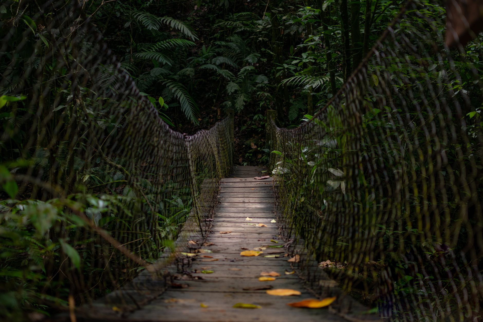
- Drive from Auckland CBD — 30-50 minutes depending on trailhead, easy to fold into a wider Piha and Waitākere Ranges day trip
- SH16 west then various access roads
- No public transport to trailheads, so hiring a car in Auckland is the usual answer
- Tour operators — Bush & Beach, Time Unlimited offer day trips with hike inclusions, NZ$130-180
- Free parking at most trailheads
The practical version: no bus, no train and no shuttle reaches any trailhead, and rideshare drivers will get you out there but not reliably back, so a guided day trip is the realistic alternative to driving. The roads matter too — Piha Road, Scenic Drive and the Bethells and Karekare approaches are narrow, winding and slower than the map suggests.
- Fill the tank first. No petrol at Piha, Karekare, Bethells or Whatipu, and no ATM either.
- Car parks are small and full by 10am on fine weekends. Before 9am or after 2pm solves most of it.
- Download the map before you leave the city. Coverage drops away fast once you are off Scenic Drive.
If you are hiring a vehicle for the trip, our Auckland car rental guide covers the practicalities, and our Auckland hikes and walking trails guide lists the tracks closer to the city if the west coast is closed or the forecast is poor.
What to Bring
- Water — minimum 1L per person per hour
- Snacks/lunch — for any hike over 1 hour
- Sturdy walking shoes — boots for muddy tracks, particularly winter
- Layered clothing — variable Auckland weather
- Quality rain jacket — even on sunny days
- Sun protection — sunscreen, hat, sunglasses
- First aid kit — for longer hikes
- Map and compass / phone GPS — backup navigation
- Headlamp — for short winter days
- Insect repellent — sandflies present in some bush areas
- Phone with charged battery — emergency contact
The Hillary Trail: Auckland’s Premier Multi-Day Hike
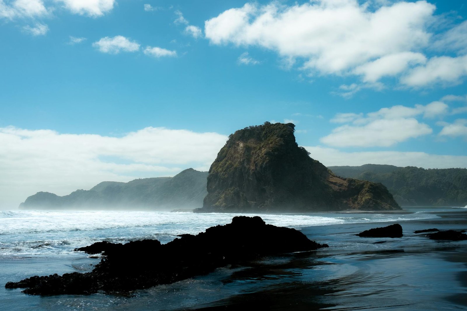
- Length: 75km point-to-point
- Duration: 4-5 days
- Start: Arataki Visitor Centre, Titirangi
- Finish: the Muriwai gannet colony
- Accommodation: DOC huts and campsites along the route
- Difficulty: Hard — significant elevation, exposed clifftops, river crossings
- Booking: Some huts require advance DOC booking
- Best season: Autumn (March-May) for settled weather
The Hillary Trail is named after Sir Edmund Hillary (NZ’s most famous mountaineer, first to summit Everest). The trail traverses the entire Waitākere Ranges along clifftops and through bush. One of NZ’s underrated multi-day hikes.
Best Time to Hike the Waitākeres
- Autumn (Mar-May) — perfect — settled weather, fewer crowds, mild temperatures
- Winter (Jun-Aug) — quietest, dramatic light, muddy tracks possible
- Spring (Sep-Nov) — variable but improving weather, native bush flowering
- Summer (Dec-Feb) — hot for exposed walks, busiest crowds, longer days
Hiking With Kids in the Waitākeres
- Best kid-friendly tracks: Kitekite Falls, Karekare Falls, Pohutukawa Glade, Tasman View
- Avoid for young kids: Te Henga Walkway (long), Hillary Trail (multi-day)
- Pram-suitable: Pohutukawa Glade Walk only
- Keep kids on tracks for kauri protection
- Bring snacks, water, first aid kit
Sample Waitākere Ranges Day Hike
- 9am — Drive from Auckland CBD via SH16
- 9:45am — Coffee in Titirangi Village
- 10:30am — Arrive Piha, Kitekite Falls trailhead
- 10:45am — Hike to Kitekite Falls (1 hour return)
- 12:15pm — Lunch at Piha Café
- 1:30pm — Mercer Bay Loop walk (1 hour return)
- 3pm — Drive 5 mins to Karekare
- 3:15pm — Karekare Falls walk (30 mins return)
- 4pm — Karekare Beach time
- 5:30pm — Drive back to Auckland
- 6:30pm — Arrive Auckland CBD
Hiking Safety
- Tell someone your plans — especially for longer hikes
- Check weather forecast — Auckland weather changes quickly
- Check track status — kauri dieback closures change
- Stay on tracks — both for safety and kauri protection
- Carry water and food — especially summer
- Mobile phone reception — patchy in Waitākere Ranges
- Heavy rain — many tracks become slippery; streams rise rapidly
- Coastal walks — never swim outside flagged areas
Arataki Visitor Centre
Located on Scenic Drive in Titirangi, Arataki is the gateway to the Waitākere Ranges. Free admission, displays on Māori and natural heritage, viewing platform with panoramic views, café. Excellent first stop for any Waitākere hike.
Specifics worth having: 300 Scenic Drive, open 9am to 5pm every day except Christmas Day and Boxing Day, rangers on 09 892 4777, entry free. There are about 40 car parks, toilets under the visitor centre during opening hours with after-hours toilets behind the education centre, drinking water outside the toilet block, and free wifi — the last reliable connection before the valleys. Park gates run 6am to 9pm in daylight saving and 6am to 7pm outside it.
The 11-metre kauri pou at the entrance, carved by Te Kawerau ā Maki, is one of the largest of its kind in the country. But the real reason to stop is the ranger desk: staff know which tracks closed after last night’s rain, and no website updates that fast. The Arataki Nature Trail from the car park is a short metalled loop and the easiest introduction to the forest.
Where to Stay for Waitākere Hikes
- Piha holiday cottages — direct trail access
- Bethells/Te Henga rentals — Lake Wainamu and Te Henga Walkway access
- Titirangi Village B&Bs — closer to Arataki than CBD
- Auckland CBD hotels — most visitors do day trips
- DOC huts/campsites along Hillary Trail — for multi-day hikers
Eating Near Waitākere Trailheads
- Piha Café — Piha trailhead, brunch and lunch
- Piha Store — burgers, fish & chips
- Bethells Cafe — small honesty-style café
- Muriwai Surf Club café — basic café food
- Titirangi Village — multiple cafés and restaurants 30 mins back to CBD
- Lopdell House Café Titirangi — refined Tudor-style café
Frequently Asked Questions
What’s the best Waitākere Ranges hike?
Kitekite Falls Track at Piha — easy 1-hour walk to a stunning 40m waterfall. Most rewarding short walk in the Waitākeres.
Are Waitākere Ranges hikes safe?
Yes with sensible precautions — stay on tracks, check weather, carry water, tell someone your plans.
Can you hike the Hillary Trail in 1 day?
No — 75km requires 4-5 days minimum. Some sections can be done as day hikes with shuttles.
What’s kauri dieback?
A fungal disease threatening NZ’s kauri trees. Many Waitākere tracks closed for protection. Use boot-cleaning stations at all trailheads.
Are dogs allowed in the Waitākere Ranges?
Mostly no — kauri protection rules. Some specific tracks allow leashed dogs. Check Auckland Council.
How long is the Kitekite Falls walk?
2.4km return, 1 hour total. Easy gravel track suitable for kids 4+.
Can I camp in the Waitākere Ranges?
Yes at designated DOC sites along the Hillary Trail. Wild camping is not permitted in the Regional Park.
Which Waitākere Ranges tracks are open right now?
Around 97 kilometres of the network is open, including Kitekite Falls, Mercer Bay Loop, Comans, Ahuahu, Pararaha Valley, Ōmanawanui and the newly reopened Zion Hill, Kuataika and Smyth Ridge tracks. Tasman Lookout, Knutzen, Laird Thomson and the Lion Rock summit are closed, Lake Wainamu is open only to the lake, and Goldie Bush has been shut since 2020. Check the council page the morning you go, because rain closes tracks at short notice.
Can you still walk the Te Henga Walkway end to end?
No. The section between Tirikohua Point and Bethells Beach was destroyed by landslides in early 2023 and DOC says it is inaccessible. Walk it as two out-and-backs instead: Constable Road at Muriwai to Tirikohua Point, about 3.6km return, or Bethells Road to O’Neill Bay and Raetahinga Point, about 4km return.
Is the Lion Rock summit track at Piha open?
No, and it is unlikely to reopen. The 2023 storms left the rock unstable, and because it is a registered archaeological site any engineered fix needs Heritage New Zealand approval. Auckland Council has been installing fencing to keep people off the summit while a longer-term plan is worked out. You can still walk around the base along the beach.
Do I need a permit to hike in the Waitākere Ranges?
No permit and no entry fee for day walks, and trailhead parking is free. What you do need is compliance with the kauri hygiene rules, and a booking if you intend to camp. Overnight sites are Auckland Council regional park campgrounds, and prices changed on 1 July 2026.
Final Take: Auckland’s Hiking Backyard
The Waitākere Ranges deliver world-class hiking 30 minutes from Auckland CBD — native bush, ancient kauri, dramatic west coast clifftops, multiple waterfalls, and Auckland’s only multi-day hike. From the easy 1-hour Kitekite Falls to the demanding 75km Hillary Trail, every fitness level finds rewarding walks here.
Check track status before visiting (kauri dieback closures), use boot-cleaning stations religiously, allow generous time, and pack for variable Auckland weather. Auckland’s hiking scene is one of the city’s most underrated assets — and the Waitākere Ranges are the heart of it.
The honest summary in 2026 is that this is a park in the middle of a long repair job, and it rewards flexibility. Have a second walk in mind, ring Arataki if you are driving out for something specific, and treat any track description more than a year old — including parts of this one — as a hypothesis. Our Piha and Waitākere day trip guide and Muriwai Beach guide cover the coast at either end.
The boot-cleaning stations at these track entrances are not a formality — kauri dieback moves in soil, and it is the same reasoning that has a biosecurity officer inspecting your soles at the airport. Our guide to the New Zealand biosecurity rules covers both ends of that, at the border and on the track.