Auckland Beaches & Outdoor Adventures: The Complete 2026 Guide
The best beaches in Auckland, ranked by swim, surf, family and scenery: Mission Bay, Takapuna, Piha, Muriwai and Rangitoto, plus top hikes and rip safety.
This article contains advertising. Our booking links are routed through a partner that adds commission tracking automatically, so if you book through one we earn a commission from the provider, at no extra cost to you. It never affects what we recommend. Affiliate disclosure
Auckland is the only big city on Earth built across a live volcanic field, pressed between two oceans, and fringed with temperate rainforest. That geography is the whole point. Inside 45 minutes of the CBD you can float in calm gulf water off a pale-gold harbour beach, get worked by Tasman surf on iron-black sand, climb a 600-year-old volcano, and walk a fern gully under nikau palms. This guide sorts Auckland by what you actually want from a day out.
Short version, if you only read one paragraph: the best beaches in Auckland split cleanly into calm east-coast swimming beaches (Mission Bay, Takapuna, Cheltenham, Long Bay) and wild west-coast surf beaches (Piha, Karekare, Bethells, Muriwai). East for a safe swim and a coffee; west for the drama and the surf, always between the flags. Add Rangitoto and Waiheke for island days, and the city’s volcanic cones for free walks with huge views. Our surfing in Auckland guide covers this in more depth.
How to think about Auckland’s two coasts
Auckland sits on a skinny isthmus. On one side is the Waitematā Harbour, which opens into the Hauraki Gulf and the Pacific. On the other is the Manukau Harbour and the open Tasman Sea. That single geographic fact decides nearly every beach choice you’ll make here, so it’s worth holding onto.
The east coast beaches face sheltered gulf water. Think St Heliers, Mission Bay, Kohimarama, Takapuna, Cheltenham, Long Bay, Orewa, Omaha. The waves are small, the currents are usually manageable, the sand is pale, and there’s almost always a café within a two-minute walk. These are swimming beaches, family beaches, sunset-drink-in-hand beaches.
The west coast faces the raw Tasman. Piha, Karekare, Bethells, Muriwai, Whatipu. Black iron-rich sand that gets genuinely painful underfoot on a hot afternoon, big surf, permanent rip currents, few facilities, patchy phone coverage. These are surfing beaches, walking beaches, photography beaches. Beautiful and, if you’re careless, dangerous.
The mistake most first-time visitors make is treating it as either/or. It isn’t. Drive to Piha in the morning for the landscape, then cool off at Mission Bay or St Heliers in the afternoon for the swim. The whole crossing is under an hour. If you want the wider lay of the land before you pick a base, our Auckland travel guide 2026 maps out the regions and how they connect.
At a glance: Auckland beaches compared
Here’s the quick reference. “Drive time” is from the central city in normal traffic; add 20 to 40 minutes on a hot summer Saturday, especially heading west.
| Beach | Coast | Best for | Drive from CBD |
|---|---|---|---|
| Mission Bay | East (gulf) | Swim, family, no car needed | 10 min |
| St Heliers | East (gulf) | Swim, sunset, cafés | 12 min |
| Takapuna | East (gulf) | Swim, family, scenery (Rangitoto view) | 20 min |
| Cheltenham | East (gulf) | Family, small kids, car-free | 25 min (or ferry) |
| Long Bay | East (gulf) | Family, picnic, coastal walk | 30 min |
| Piha | West (Tasman) | Surf, scenery, waterfall walk | 45 min |
| Karekare | West (Tasman) | Scenery, photography, quiet surf | 50 min |
| Bethells / Te Henga | West (Tasman) | Surf, scenery, dune lakes | 45 min |
| Muriwai | West (Tasman) | Surf, scenery, gannet colony | 40 min |
| Cornwallis / Huia | West (harbour) | Family, calm swim on the west side | 50 min |
| Rangitoto (island) | Gulf island | Scenery, summit walk, volcano | 25 min ferry |
| Onetangi (Waiheke) | Gulf island | Swim, scenery, wine day | 40 min ferry + bus |
Safety first: rips, tides, and why the west coast is not to be underestimated
I’m putting this near the top on purpose, because it’s the part people skim and then regret. Auckland’s west coast is genuinely hazardous water, and the summer of 2025 was a grim reminder. In a matter of weeks the region saw several deaths on this coast, including a fisher swept off rocks and swimmers caught out to sea. Local lifeguards openly described Piha as being about as dangerous for the unfamiliar as they’d seen it. The water often looks calm and inviting. That calm is frequently a rip.
A rip current is a fast, narrow flow of water heading back out to sea, and it can move at up to two metres per second, quicker than any of us can swim against. The Tasman beaches create these permanently. The consistent factor in west-coast fatalities is almost always the same: people in the water outside patrol hours, or outside the flags.
So the rules, plainly. Swim only between the red-and-yellow flags. The patrolled west-coast beaches are Piha, North Piha, Karekare, Bethells (Te Henga), Muriwai, and Kariaotahi, with volunteer surf clubs on duty through summer, usually from Labour Weekend in late October to around Easter, roughly 10am to 6pm on patrol days. Outside those flags and those hours, don’t go past your knees. That’s not caution for its own sake; that’s where people drown.
If you are ever caught in a rip, the advice from Surf Life Saving is to stay calm and not fight it. Float, keep your head above water, and raise one arm to signal for help. A rip will usually carry you out past the breakers, where it loses power, and then you can swim sideways across it, parallel to the beach, before heading back in. Panic and exhaustion kill; the current itself often doesn’t.
The single most useful habit for any Auckland beach day is to check safeswim.org.nz the morning you go. It carries live water-quality, rip, and surf ratings for every patrolled beach in the region, plus the lifeguard hours for that day. Two minutes on your phone, and you’ll know before you leave whether it’s a green light or a stay-on-the-sand day.
The east coast is far gentler but not risk-free. The usual hazards are stingrays resting in warm shallows in summer (shuffle your feet as you wade so they feel you coming and move off), the occasional bluebottle jellyfish blown in on an easterly, and, more often than people expect, bacteria after rain. Don’t swim at any Auckland beach within about 48 hours of heavy rain. Stormwater overflow regularly pushes E. coli above safe levels, particularly at spots like Mission Bay, Cox’s Bay, Judges Bay, and Weymouth. Safeswim flags these in real time too.
The east coast: Auckland’s swimming beaches
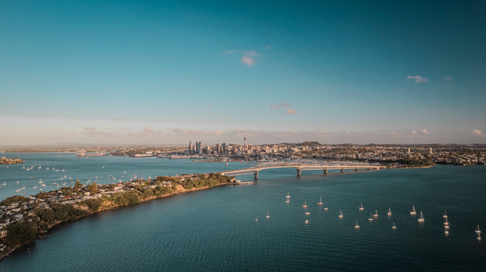
If your priority is a straightforward, safe swim and somewhere to eat afterwards, this is your coast. Every beach below is patrolled or calm enough not to need it, and most are reachable without a car.
Mission Bay
Ten minutes from the city along Tamaki Drive, Mission Bay is the most central beach in Auckland and the default choice for visitors staying downtown. It’s a 400-metre curve of gentle sand looking straight across to Rangitoto, backed by a shaded promenade, a heritage fountain, and a long strip of cafés, gelato counters, and restaurants right across the road. It gets busy on summer weekends, but if you don’t have a car it’s unbeatable: the 781 bus runs from downtown every 15 minutes or so. Swimming is best around high tide; at low tide the water pulls back a long way and you’ll want jandals or reef shoes for the shell grit. For the full breakdown of parking, tides, and where to eat, see our Mission Bay beach guide.
St Heliers
Two minutes further east, St Heliers is Mission Bay’s quieter, slightly more polished neighbour. The beach is a touch longer, the village coffee is arguably better, and the outlook to Rangitoto is a little cleaner. Free parking is usually easier to find than at Mission Bay. This is my pick for a sunset swim, because the harbour faces you west toward the Sky Tower skyline and the light goes properly pink behind the city.
Kohimarama
Tucked between Mission Bay and St Heliers, “Kohi” is the middle sibling and where a lot of local parents with young kids actually end up. The sand runs wider than Mission Bay, the water stays calm, and there’s a decent playground behind the sea wall. There’s less food within walking distance, which is exactly why it’s quieter.
Takapuna
The North Shore’s answer to Mission Bay, and a strong contender for the best beach view in the whole city. Takapuna is a long stretch of fine, pale sand sitting directly under the silhouette of Rangitoto. Reach it via the Devonport ferry plus a short drive or bus, or the NX1 busway and a transfer. The village behind is one of the Shore’s best for eating, with a well-regarded Sunday farmers’ market (8am to noon) and a proper dinner strip along Hurstmere Road. Our Takapuna Beach guide covers the market, the coastal walk to Milford, and where to park.
Cheltenham and Narrow Neck
Out on the Devonport peninsula, Cheltenham is about the best small-kid beach in Auckland: sheltered, sandy, and shallow with a gently sloping bottom, so toddlers can paddle a long way out and still be ankle-deep. It’s patrolled in summer and only about 15 minutes’ walk from the Devonport ferry, which makes it a genuinely doable car-free beach day from the CBD. Narrow Neck, a kilometre around the corner, adds a grassy reserve, clean flat sand, and its own clear view of Rangitoto.
Long Bay
Thirty minutes north at the top of the motorway, Long Bay is Auckland’s biggest regional beach park, and my default recommendation for a picnic-plus-swim family day. The beach is a kilometre of pale sand with a walk-in shallow entry, backed by a large grassy reserve with a playground, BBQs, changing rooms, and toilets. Entry is free, though parking can fill and be charged at peak times. It’s also the trailhead for the Long Bay–Okura coastal walkway, about 5km one-way through pōhutukawa-lined cliffs to one of the region’s best marine reserves at the Okura estuary. Easy enough for reasonably fit kids, and a lovely pairing with a swim. Pair this with our Auckland coastal walks guide.
Orewa, Omaha, and further north
Keep driving north and the beaches get longer and quieter. Orewa (40 minutes) is a 3km beach town with gentle east-coast surf and a walkable main street. Omaha (an hour) is the East Coast Bays’ answer to the Hamptons, 4km of fine sand backed by designer baches, patrolled in summer, with a calm lagoon behind it that’s flat enough for paddleboarding with toddlers. Ninety minutes up, inside Tāwharanui Regional Park, is arguably the single most beautiful beach in the region: a 2km white arc inside a predator-fenced sanctuary, with water clear enough to snorkel. Pakiri, just past Omaha, is 14km of near-empty sand where Pakiri Beach Horse Rides runs beach rides year-round. All of these make excellent day trips, and several feature in our roundup of the best day trips from Auckland.
Goat Island (Leigh): the snorkelling one
Near Pakiri, the Goat Island Marine Reserve (Cape Rodney–Ōkakari Point) is New Zealand’s oldest, established back in 1975. The water is so clear and the fish so tame that wading in to knee depth will have snapper and blue maomao circling your ankles. Hire a mask and snorkel from Goat Island Dive by the beach (around $30 a day), swim out 30 metres or so, and you’ll spot kingfish, crayfish tucked in crevices, and the odd stingray in summer. It’s the best shore-based snorkelling within easy reach of Auckland. Allow a full day with the drive.
The west coast: Auckland’s surf and wild-beauty beaches
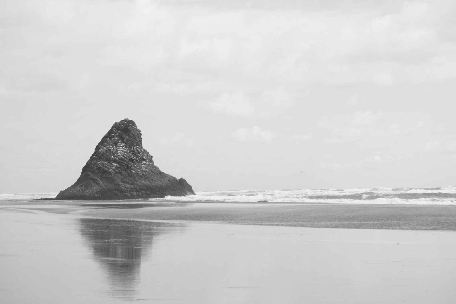
This is the coast people photograph and remember. Black sand, huge skies, thundering surf. Treat the water with respect and this is some of the most spectacular coastline in the country, an hour from a major city.
Piha
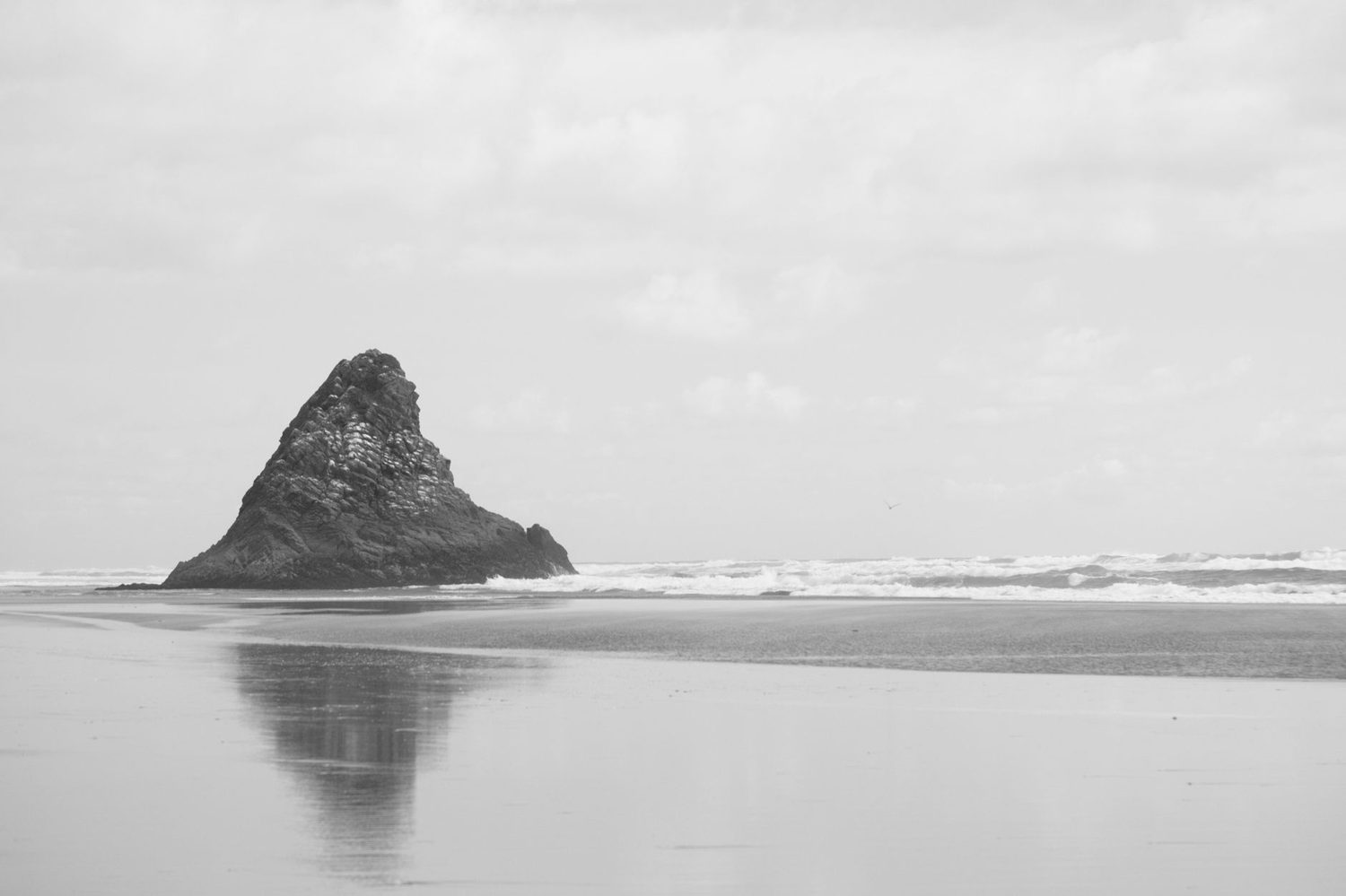
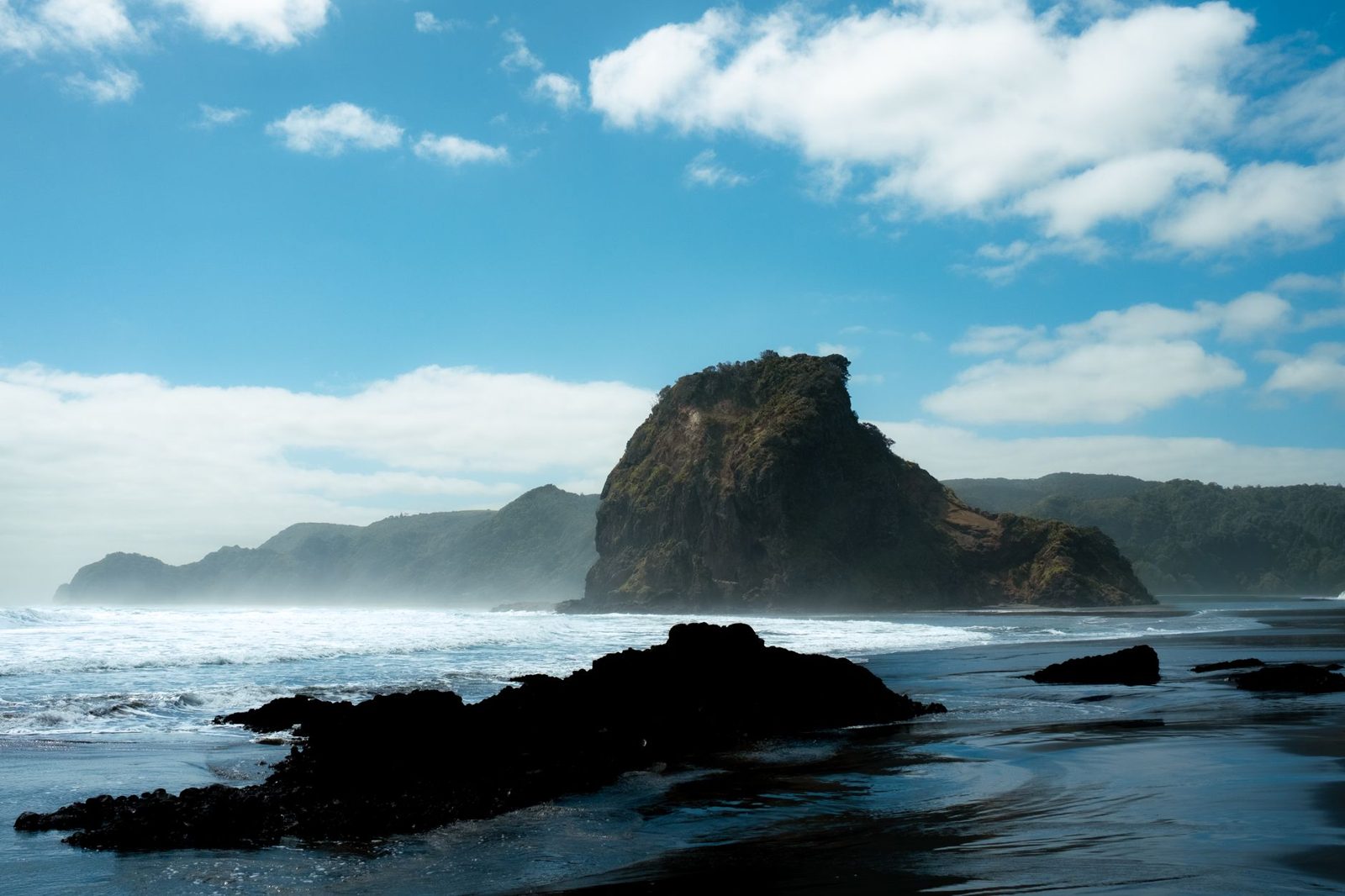
Forty-five minutes west via the Scenic Drive, Piha is the most famous beach in New Zealand and, for many, the emotional centre of Auckland’s west coast. Two kilometres of black iron-sand are split by Lion Rock, a 101-metre volcanic plug you can walk around the base of (the summit track has been closed for years pending stabilisation, so don’t plan on climbing it). North Piha, the quieter end, is the trailhead for the Kitekite Falls walk, a beautiful bush track to a tiered waterfall, though as of late 2025 the loop was cut by a damaged bridge and it’s an out-and-back from Glenesk Road for now, with the loop expected back during 2026. There’s a small café and store, a surf school running two-hour beginner lessons (around $90 with board and wetsuit), and a surf club patrolling in summer. Swim only between the flags. For everything from where to park to the best time of day, read our full Piha Beach guide.
Karekare
Piha’s quiet twin, ten minutes south down a steep, winding road. Karekare was the setting for Jane Campion’s The Piano, and to my eye it’s the more dramatic of the two: a wide black-sand plain, a big rolling dune behind it, and the Karekare Falls just a five-minute walk from the car park. There are no shops and no café here, so pack everything in and carry your rubbish out. It’s patrolled in summer but far less crowded than Piha, which makes it a favourite of photographers and of surfers who want fewer people in the lineup. Our Karekare Beach guide has the road, the falls walk, and the safety detail.
Bethells Beach (Te Henga)
Forty-five minutes west, sitting between Piha and Muriwai, Bethells is the wildest-feeling of the patrolled west-coast beaches. Twin headlands frame a long black strand, and a short walk up the Waiti Stream from the car park reaches a chain of freshwater dune lakes, the ones used for the dune-boarding scene in the 2016 Pete’s Dragon. It’s patrolled in summer, so swim between the flags and skip the water when there are none. There are fewer day-trippers here than at Piha or Muriwai, and no facilities to speak of, so bring lunch and water. Our Bethells Beach (Te Henga) guide covers the dune-lake walk and getting there.
Muriwai and the gannet colony
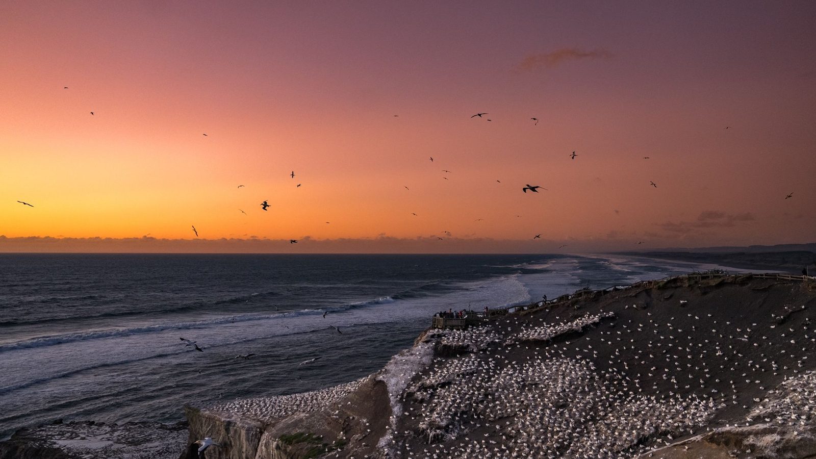
Forty minutes northwest, Muriwai pairs a serious surf beach with one of Auckland’s genuine wildlife spectacles: the takapu, or Australasian gannet, colony at Ōtakamiro Point. More than a thousand pairs nest on the cliffs and stacks here every year from around August through to March, with the busiest, chick-filled months from November into February. By April the birds have mostly left for Australia and the cliffs sit empty through the winter. Viewing platforms put you just metres from the birds, and fly-bys pass close overhead. The council reopened the gannet viewpoints in December 2024 and has been upgrading the viewing area, so it’s worth a quick check of current access before you go, especially as west-coast parks are still recovering from 2023 storm damage and a 2025 fire. The beach itself runs some 60km north, the longest in Auckland, is patrolled in summer, and has a café at the surf club, and our Muriwai Beach guide goes deeper on the gannet season, the surf breaks, and where to park.
Whatipu and the harbour-side west
At the far south of the Waitākere Ranges, Whatipu is the wildest and least-visited beach of the lot, about an hour from the city with a stretch of unsealed road at the end. It opens onto the mouth of the Manukau Harbour, near the bar where HMS Orpheus was wrecked in 1863 with heavy loss of life. There are no patrols, no facilities, and some of the most dangerous rips in the country. Do not swim here. Come for the enormous dunes, the limestone caves behind the beach, and the sense of standing at the edge of something. For a west-coast swim that’s actually safe, cross to the harbour side: Cornwallis and neighbouring Huia sit sheltered behind the Āwhitu Peninsula, where the water is flat and shallow. The drive through Huia is one of the prettiest coastal roads in Auckland.
Island beaches: Rangitoto and Waiheke
Two of Auckland’s best beach-and-outdoors days aren’t on the mainland at all. Both are a short ferry from downtown, and both feel like a different world.
Rangitoto Island: a volcano 25 minutes offshore
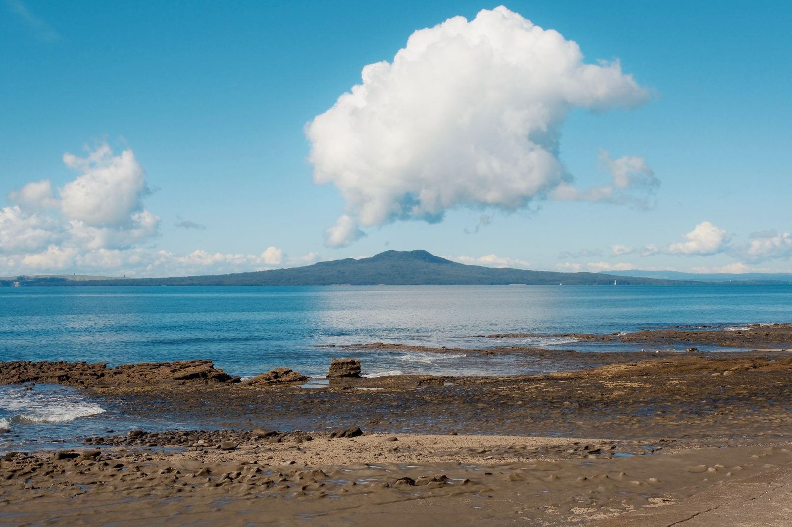
Rangitoto rose out of the sea in a series of eruptions around 600 years ago, which makes it the youngest and by far the largest volcano in the whole Auckland field, and its near-perfect cone is the shape you’ll see on the horizon from almost every east-coast beach. Fullers360 runs the ferry from downtown in about 25 minutes; expect roughly $42 to $45 for an adult return. One important change worth flagging: bookings are now time-specific and essential, and walk-on tickets are no longer sold for the summit trip, so book online before you go rather than turning up at the wharf.
The Summit Track is about 2.3km each way from Rangitoto Wharf, climbing roughly 260 metres, and most people take around an hour up and a bit less down. The reward is a 360-degree view over the entire Hauraki Gulf, out to the Coromandel and, on a clear day, Great Barrier Island. Near the top, a 30-minute detour drops through a set of lava caves, so bring a torch or use your phone light.
A few things make Rangitoto unusual. It’s pest-free, and its scoria fields hold the largest pōhutukawa forest in the country, which lights up crimson from mid-December into early January. There’s no drinking water on the island, no café, and essentially no shade, so carry at least two litres of water per person and sunscreen whatever the season. And take the return ferry times seriously: miss the last boat and you’re spending the night on bare lava. If the walk isn’t for you, a 4WD-towed Volcanic Explorer tour lifts you most of the way to the summit lookout.
Waiheke Island beaches
Thirty-five to forty minutes by passenger ferry from downtown, Waiheke is best known for its wine, but its beaches stand on their own. Onetangi is the island’s longest, a 2km sweep of pale sand with a handful of bars and cafés looking straight over it, ideal for a long swim-and-lunch afternoon. Oneroa, the main village beach, is calm, north-facing, and lined with pōhutukawa, with grassy terraces above it. Palm Beach, between the two, is a compact, family-friendly cove with a playground and a village nearby. Ferries land at Matiatia, and a local bus network fans out to all three. It’s an easy full day, and pairs naturally with a vineyard lunch; it also turns up in our wider list of things to do in Auckland.
Auckland’s volcanic cones: free walks with the best views in the city
Auckland is the only major city in the world built on an active volcanic field, with 53 separate volcanic centres, scoria cones, tuff rings, maars and small shields, scattered across the isthmus. More than a dozen are public reserves you can walk, and they’re all free. If you want the full geological story, our deep dive on Auckland’s volcanoes and their geological history covers all 53 cones and how the field formed. For a first visit, four stand out.
- Mt Eden (Maungawhau) is the highest natural point on the isthmus at 196 metres and only ten minutes from the CBD. The crater is sacred to mana whenua, so stay on the marked paths and don’t walk into it. Private cars can no longer drive to the summit; there are visitor car parks at the base off Mountain Road and Puhi Huia Road, and it’s a walk of roughly 15 to 20 minutes up, with a paid council shuttle for those who need it. Sunrise here is one of the great free experiences in Auckland. Our Mt Eden summit walk guide has the routes, the parking, and the maunga etiquette.
- One Tree Hill (Maungakiekie), 182 metres, sits inside Cornwall Park and was historically the largest pā, or fortified village, on the isthmus. You can walk up from the park entrance for views across South Auckland and the Manukau Harbour.
- Mt Victoria (Takarunga), 87 metres, is a five-minute walk from the Devonport ferry and delivers the best CBD skyline photograph in the city.
- North Head (Maungauika), Devonport’s other cone, is riddled with WWII gun emplacements and tunnels you can explore with a torch.
All four are walkable in under 45 minutes return. A neat “volcano day” for the price of the Devonport ferry: Mt Eden at sunrise, North Head’s tunnels around midday, Mt Victoria for the skyline at sunset.
Bush walks, waterfalls, and the Waitākere Ranges
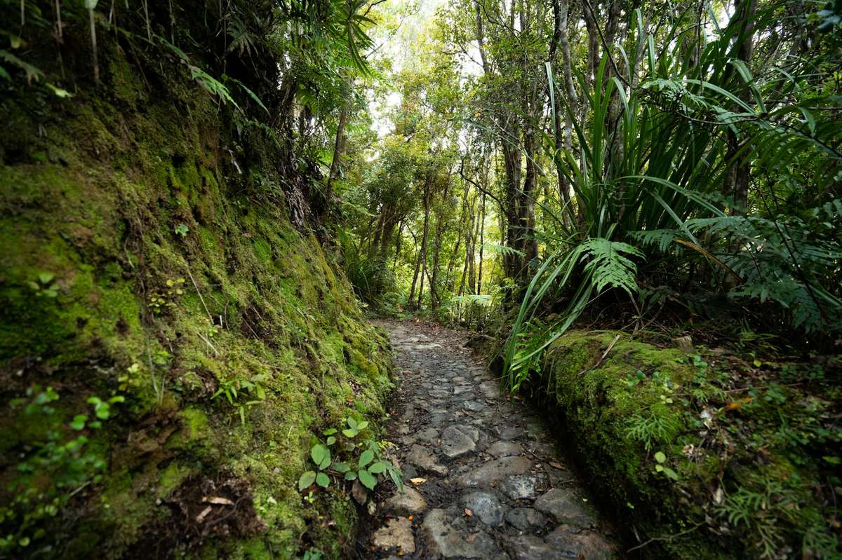
The Waitākere Ranges cover about 16,000 hectares of dense subtropical rainforest immediately west of the city, and they hold many of Auckland’s best waterfalls, coastal cliffs, and lookouts, which our guide to the best Waitākere Ranges walks covers track by track. There’s an important caveat for 2026, though. Since 2018 a large number of forested tracks have been closed under a Controlled Area Notice to slow the spread of kauri dieback (Phytophthora agathidicida), a soil-borne disease that kills kauri trees. On top of that, west-coast parks are still working through storm damage from 2023 and fire damage from 2025, so some tracks and bridges are out even where the forest is open.
What this means in practice: always check the current track status on aucklandcouncil.govt.nz before you drive out, because closures change, and always scrub your footwear at the hygiene stations at every track entrance. It genuinely helps.
Tracks that have typically been open include the short loops at the Arataki Visitor Centre (worth the drive on its own for the panorama terrace and the carved pouwhenua), the Karekare Falls walk (five minutes), the Mercer Bay Loop (about an hour, and one of the finest coastal cliff walks in the region), and, with the bridge caveat above, Kitekite Falls at Piha as an out-and-back. The full 80km Hillary Trail through-walk remains largely closed. Whatever you tackle, carry a rain shell and wear proper shoes regardless of the weather at the car park, because the bush makes its own weather.
Two more waterfall options outside the Waitākeres are worth a half-day. Hunua Falls, about 50 minutes southeast in the Hunua Ranges, drops around 30 metres into a pool that’s a summer swimming hole; a 10-minute walk gets you to the main viewpoint, and the longer Cossey–Kingsway loop (roughly two hours) climbs to the dam and back through forest. And the Long Bay–Okura coastal walk mentioned earlier is a gentle, kid-friendly bush-and-clifftop option you can bolt onto a beach day.
The Coast to Coast Walkway
If you want to understand Auckland’s geography in a single day on foot, walk the Coast to Coast. It’s a 16km urban trail that crosses the isthmus from the Waitematā Harbour at the Viaduct to the Manukau Harbour at Onehunga, linking a string of volcanic cones and green spaces including Albert Park, Mt Eden, and One Tree Hill along the way. Allow four to six hours, or split it into two halves using local bus routes. It’s free, the council publishes a map online, and it is one of the twelve routes in our roundup of Auckland’s best hikes and walking trails. For getting yourself to trailheads and beaches without a car, our guide to getting around Auckland lays out the buses, trains, and ferries.
On the water: surfing, kayaking, paddleboarding, sailing
Surfing
Learn at Piha with the surf school there (two-hour group lesson around $90, board and wetsuit included; book ahead for summer weekends), or at Muriwai, which often has slightly friendlier beginner conditions. October to April is the best window to start, but the Tasman stays cool all year, so you’ll want a wetsuit even in January. More confident surfers head to Piha’s reef breaks either side of Lion Rock, Muriwai’s long beach break, or up to Pakiri for emptier, mellower peaks.
Sea kayaking
The signature Auckland paddle is the sunset kayak across to Rangitoto. Auckland Sea Kayaks, the only operator with a guiding concession on the island, runs a guided sunset-and-night trip that departs from the St Heliers boat ramp, paddles the Waitematā, walks you to the summit for sunset, feeds you a BBQ dinner at the water’s edge, and paddles back under the city lights (from around $225, and worth it). For something shorter, you can hire doubles at Takapuna Beach to potter along the gulf coast, or explore the Viaduct and Westhaven marina. Flatwater paddlers love the Puhoi River run down to Wenderholm Regional Park. If you want more on that side of things, see our kayaking Auckland guide.
Stand-up paddleboarding
SUP boards are for hire at Mission Bay, Takapuna, Mairangi Bay, Orewa, and Omaha, generally $25 to $35 an hour. The most photogenic spot is anywhere on the east coast at high tide with Rangitoto on the horizon. For absolute beginners and kids, the Omaha lagoon is completely flat and about as safe as open water gets.
Sailing
Auckland isn’t called the City of Sails for nothing; there are more boats per head here than in just about any city on Earth. The classic visitor experience is a two-hour skippered harbour sail (around $90), or, for something with more history, a sail aboard one of the actual former America’s Cup racing yachts, where you’re put to work grinding winches (around $175). Both leave from the Viaduct. If food and wine are more your speed afterwards, our Auckland food and drink guide points you to the best of the waterfront and beyond.
Adventure and wildlife
Adrenaline in the city
The Sky Tower’s SkyJump is an 11-second, 85kph base-jump-by-wire from 192 metres up, landing on the plaza below; the SkyWalk is a hands-free (harnessed) walk around a narrow external platform at the same height. AJ Hackett runs a Bridge Climb up the Auckland Harbour Bridge and a Bungy that drops you toward the Waitematā from the middle of it, both from Westhaven. Book online ahead in summer, as same-day slots are scarce. The most distinctively west-Auckland adventure, though, is canyoning: full-day guided trips abseil waterfalls and slide natural rock chutes through the Waitākere bush, 45 minutes from downtown, best from October to April.
Wildlife encounters
The Auckland region is unusually wildlife-rich, largely because Hauraki Gulf islands have been systematically cleared of predators over the past few decades. Beyond the Muriwai gannets and Goat Island snorkelling, the standouts are:
- Tiritiri Matangi, a 75-minute Fullers360 ferry to an open sanctuary where you can see takahē, kōkako, tuatara, and dozens of species you’ll never spot on the mainland. A guided day trip runs around $120.
- Kelly Tarlton’s Sea Life Aquarium on Tamaki Drive, with underwater tunnels through shark and stingray tanks and a sub-Antarctic penguin exhibit.
- Auckland Zoo at Western Springs, strong on New Zealand natives including kea, kiwi, and tuatara.
- Shakespear Regional Park, 45 minutes north, a predator-fenced headland where pūkeko, takahē, and kākā roam free beside sandy beaches. Free to enter.
- Auckland Whale & Dolphin Safari, a 4.5-hour Hauraki Gulf expedition from the Viaduct with regular dolphin and Bryde’s whale sightings and occasional orca; it’s the only year-round city-based whale operation in the country.
Practical planning
What to pack for an Auckland outdoor day
The old line about Auckland getting “four seasons in one day” is annoyingly accurate. A sensible kit: a lightweight rain shell even when the forecast is sunny; layers, because the coast can run 5 to 8°C cooler than the city at midday; strong reef-friendly sunscreen, because New Zealand’s UV is fierce even under cloud; at least two litres of water per person; insect repellent in summer (sandflies at Bethells, mosquitoes in the Waitākeres); and closed-toe shoes for any bush track with a kauri-dieback cleaning station, since you’ll need to scrub. For the west coast specifically, add a hat, as there’s next to no natural shade and that black sand throws heat.
When to visit which beach
Auckland’s beach season peaks in January and February, when sea temperatures reach roughly 20 to 22°C on the harbour beaches. The east coast is comfortably swimmable from about mid-November to mid-April; the west coast never really warms up, so plan on a wetsuit in the shoulder months. Winter (June to August) isn’t for swimming, but it’s superb for dramatic Piha and Muriwai walks, storm-watching, and whale-watching in the Gulf as humpbacks migrate through. Spring (September to October) gives you the best weather-to-crowd ratio all round, and the Muriwai gannets are on the cliffs from August into autumn.
Accessibility
Mission Bay, St Heliers, Takapuna, Orewa, and Long Bay all have sealed accessible promenades reaching the sand edge, and beach wheelchairs can usually be borrowed free at Mission Bay and Takapuna if you contact the surf clubs ahead. Piha, Karekare, and Muriwai have sand-only approaches that aren’t wheelchair-accessible past the car park, and Rangitoto’s scoria summit track isn’t either; the Volcanic Explorer tour is the accessible way to reach that summit lookout.
Dog-friendly beaches
Auckland Council runs a seasonal dog schedule. Through summer (Labour Weekend to the end of March), dogs are barred from most city beaches between 10am and 6pm, with off-leash access in the early morning and evening. Some beaches, such as the Cheltenham end at Devonport and parts of Browns Bay and Mairangi Bay, allow off-leash access year-round. Always read the signage at the beach entrance, because the rules vary block by block.
A sample two-day outdoor itinerary
Day 1, east coast and volcanoes. Sunrise at Mt Eden, then breakfast in Mt Eden village. Mid-morning, catch the Rangitoto ferry (booked ahead) for the summit walk and lava caves, and eat lunch on the boat back. Afternoon, ferry to Devonport for Mt Victoria and the North Head tunnels, then a swim at Cheltenham if the weather’s kind. Dinner in Devonport village, evening ferry home.
Day 2, west coast and the ranges. Drive the Scenic Drive to the Arataki Visitor Centre for the panorama, then on to Piha by mid-morning for the Kitekite Falls walk (out-and-back for now). Lunch at the Piha café or a packed picnic. Early afternoon, drop 10 minutes south to Karekare for the falls and beach time, then finish with the Mercer Bay Loop for the sunset cliff view before heading back to the city for dinner.
Frequently Asked Questions
Can you swim at Piha?
Yes, but only between the red-and-yellow flags and only when the surf club is patrolling, roughly 10am to 6pm from late October to around Easter. Outside those flags and hours, don’t go past your knees. Piha has permanent rip currents that have caused multiple drownings, including strong swimmers, and 2025 was a particularly bad summer for incidents on this coast. It’s the single most important rule in this guide.
What’s the difference between Auckland’s east and west coast beaches?
The east coast faces the sheltered Waitematā Harbour and Hauraki Gulf: calm, pale-gold sand, swimming-friendly, and lined with cafés. The west coast faces the open Tasman: big surf, black iron-sand, wild scenery, strong rips, and few facilities. Most visitors want one of each, the east for a swim and the west for the landscape.
Which are the best beaches in Auckland for families?
Cheltenham in Devonport is hard to beat for small children thanks to its shallow, calm water and easy ferry access. Long Bay Regional Park wins for space, playground, and BBQs; Takapuna for the sheer volume of amenities; and the Omaha lagoon for absolutely flat, safe water. All are east-coast harbour beaches.
Where can I snorkel near Auckland?
Goat Island Marine Reserve at Leigh is the best shore-based snorkelling within easy reach, with clear water, tame fish, and gear hire right at the beach. Tāwharanui Regional Park has a smaller, quieter marine reserve with similar conditions. The harbour beaches like Mission Bay have murky water and few fish, so they’re for swimming rather than snorkelling.
How long is the Rangitoto summit walk, and do I need to book?
It’s about 2.3km each way from the wharf, roughly 260 metres of climb, and most people take two to three hours return including the lava caves. The surface is uneven scoria, so wear sturdy shoes. Yes, you need to book: Fullers360 ferry tickets are now time-specific and there are no walk-on tickets for the summit trip, so reserve online before you travel.
Can you see the Muriwai gannets all year?
No. The takapu (Australasian gannets) are at Muriwai from around August through March, with peak activity and chicks from November into February. By April most have left for Australia, and the cliffs are empty through winter. Check current viewing-area access before you go, as the platforms have been undergoing upgrades.
Final thoughts
No other major city lets you surf a black-sand beach, climb a 600-year-old volcano, and snorkel with kingfish in a marine reserve across a single long weekend. The tricks to doing it well are simple and worth repeating: check safeswim.org.nz the morning of any beach day, check the council’s track-closure list before driving west, pack a rain shell whatever the sky’s doing, and always respect the flags. Do those four things and Auckland’s outdoor hit rate is about as high as any city on the planet.
Ready to build the rest of your trip around all this? Our 65 best things to do in Auckland covers the non-beach side of the city, and if you’re travelling with little ones, our Auckland with kids guide is built around exactly the shallow beaches, easy walks, and wildlife parks above. To pick the right base near the water, see where to stay in Auckland and our Auckland neighbourhoods guide. And if you’re timing a visit around an event, the Auckland events and festivals calendar runs month by month.
Last updated: July 2026. Written by the Auckland Tourism Guide team.
Photo credits
- Photo: Tom Macret via Pexels
- Photo: Ollie Craig via Pexels
- Photo: Roberto Machain via Pexels
- Photo: Amanda Brabant via Pexels
- Photo: leyvaine davids via Pexels