History of Auckland: From Tāmaki Makaurau to Today
The history of Auckland, from Māori settlement of Tāmaki Makaurau and the 1840 founding through the capital era to the modern Pacific city — with sites to visit.
This article contains advertising. Our booking links are routed through a partner that adds commission tracking automatically, so if you book through one we earn a commission from the provider, at no extra cost to you. It never affects what we recommend. Affiliate disclosure
I have spent years walking Auckland’s volcanic cones with visiting friends, and the question that comes up most is some version of “so how old is this place, really?” The honest answer surprises people. Auckland’s story runs back more than 700 years, and the city you see today sits directly on top of it — the pā terraces are still cut into the hills, the harbour that decided everything is still there, and the name Tāmaki Makaurau still carries the reason people fought over this isthmus for centuries.
This is my rundown of the history of Auckland, from the first Māori settlers to the modern Pacific city, told with the places you can actually go and stand in. I have kept the dates and details tight, because a lot of what circulates about this city’s past is fuzzy. Our Auckland theatres and performing arts guide covers this in more depth.
The short version
Māori settled the Tāmaki isthmus around 1350 and named it Tāmaki Makaurau. Governor William Hobson founded colonial Auckland in 1840 on land gifted by Ngāti Whātua, and it served as New Zealand’s capital from 1841 until 1865, when the seat of government moved to Wellington. The city then grew into today’s diverse Tāmaki Makaurau.
Auckland history at a glance
| Era | Roughly when | What happened |
|---|---|---|
| Māori settlement | c. 1350 onward | Iwi settle the isthmus; fortified pā built on the volcanic cones |
| European contact | 1769-1839 | Cook charts the coast; traders, whalers and missionaries arrive |
| Treaty of Waitangi | 1840 | Te Tiriti signed; Ngāti Whātua gift land on the Waitematā |
| Capital era | 1841-1865 | Auckland is the capital of New Zealand |
| Loss of capital | 1865 | Government moves to more central Wellington |
| Victorian growth | 1870s-1900 | Gold, gum and shipping fuel expansion |
| Modern city | 1900-2000 | Harbour Bridge, Pacific migration, Sky Tower |
| Super City | 2010 | Eight councils merge into Auckland Council |
If you want the wider cultural context around all of this, the pillar guide to Auckland Māori Culture, History & Heritage: The 2026 Visitor’s Guide is the place I would start.
Why the land mattered so much
You cannot understand this history without understanding the ground it happened on. Auckland sits on a volcanic field of around 53 separate centres — most of them dormant cones, none currently active, but all geologically young. Rangitoto, the flat-topped island you see from just about every east-coast beach, erupted only about 600 years ago, well within the span of human settlement here. People watched it happen.
Two things made this place worth fighting for. The volcanic soils were rich, which meant serious horticulture was possible. And the isthmus is pinched narrow between two harbours — the Waitematā to the north and east, the Manukau to the south and west — so whoever held it controlled the portage between two coasts and had access to seafood, shellfish and safe anchorage on both sides. Rich soil, two oceans, and cones you could fortify. That combination is the whole story in miniature.
Māori Tāmaki Makaurau (c. 1350-1840)
“Tāmaki desired by many”
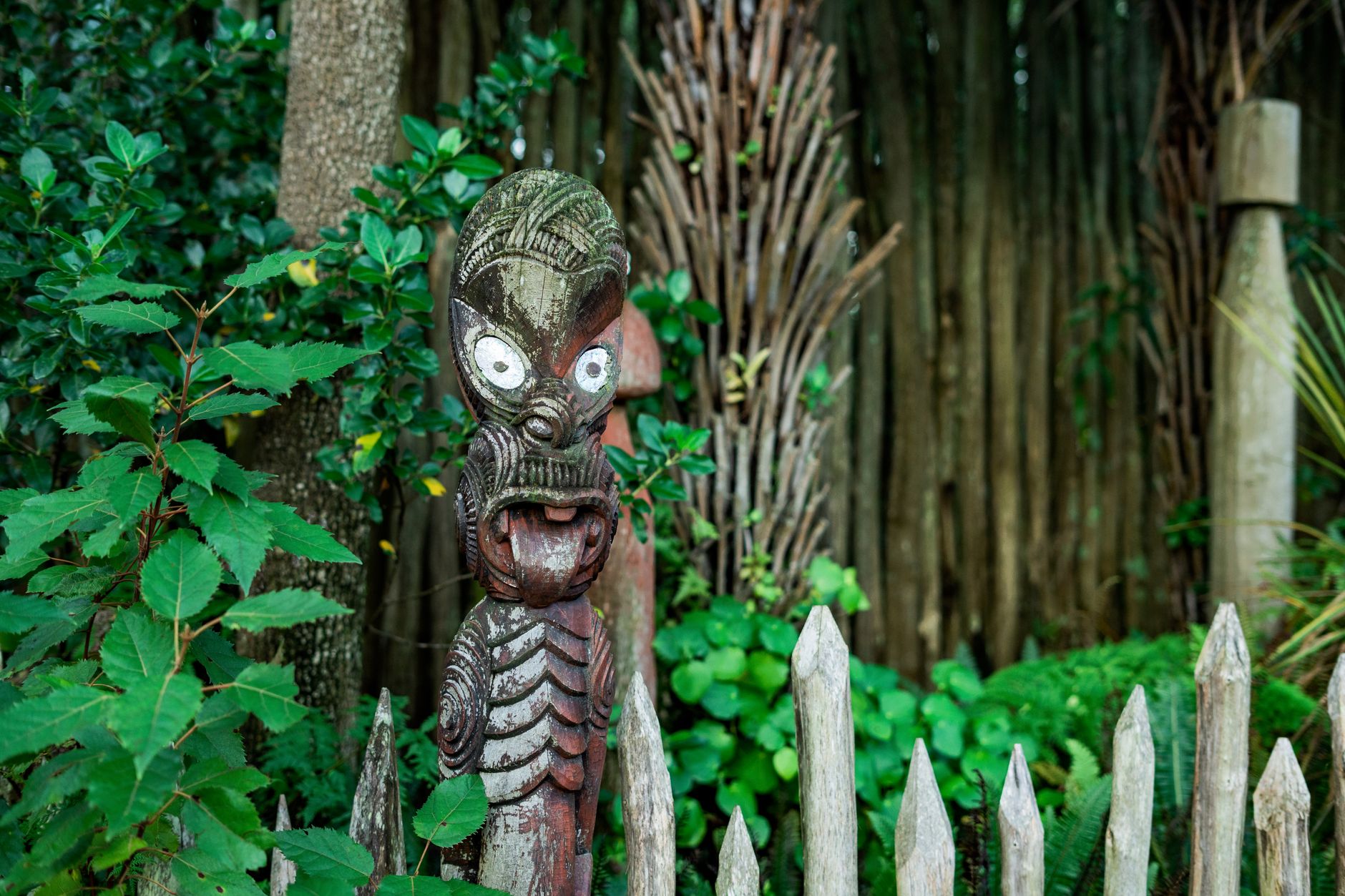
Māori reached Aotearoa from the wider Pacific around 1280, and the Tāmaki isthmus was settled by roughly 1350. The name says it all: Tāmaki Makaurau is usually translated as “Tāmaki desired by many,” a reference to how many groups wanted this ground. Over the centuries a number of iwi held and contested the region, among them Te Wai-o-hua and Ngāti Whātua.
Pā on the cones, gardens across the plains
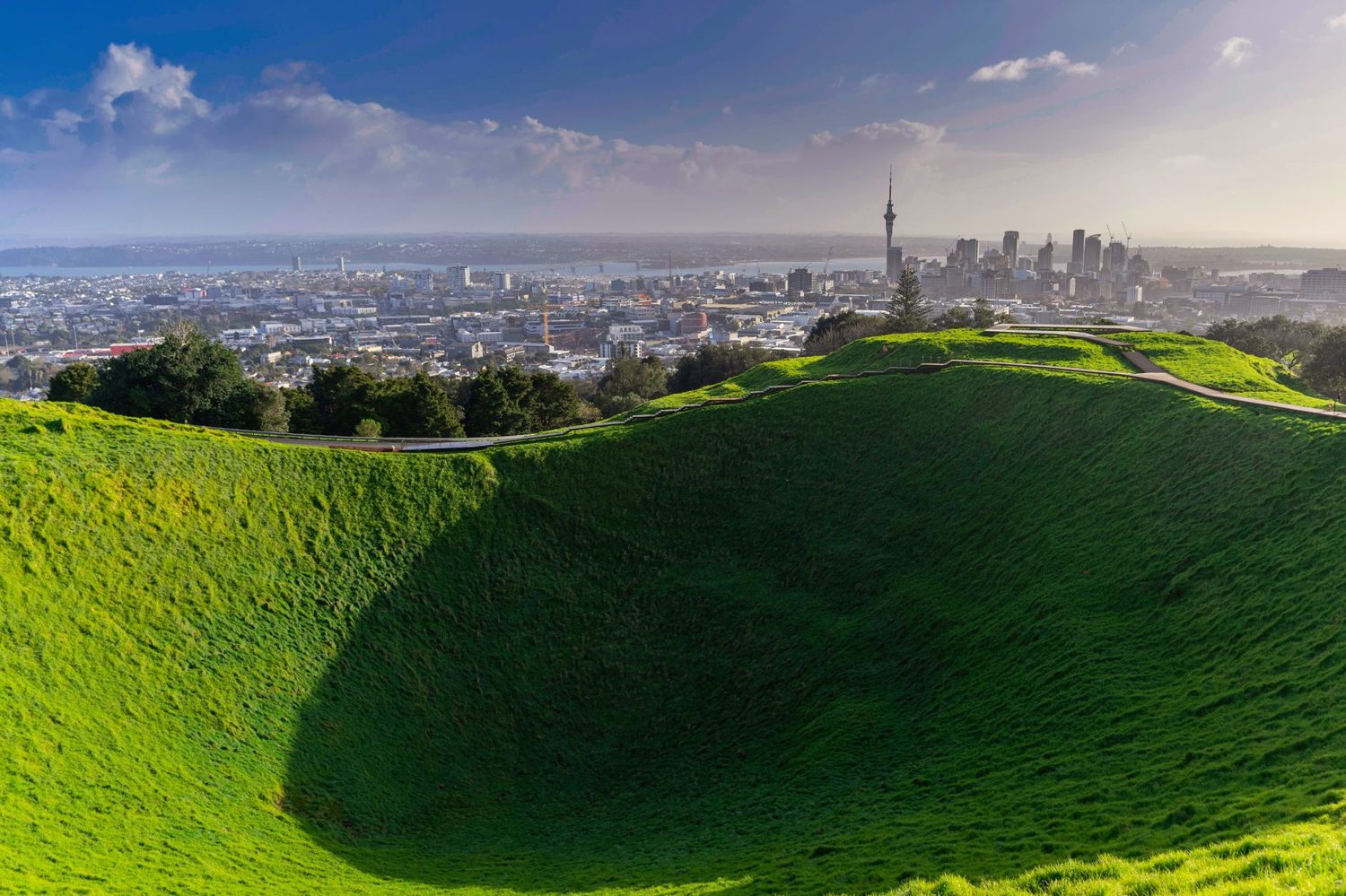
From about 1600 the Tāmaki tribes terraced the volcanic cones into fortified pā — Maungawhau (Mt Eden), Maungakiekie (One Tree Hill), Maungarei (Mt Wellington) and dozens more. Maungakiekie was the big one, a stronghold that supported thousands of people at its height. Between the cones, the iwi worked large areas of kūmara gardens, dug storage pits and built stone walls to protect the crops. At its peak the isthmus was one of the most densely populated parts of the country.
Climb Maungawhau today and you are walking on those terraces. The grooves in the hillside are not natural; they are engineering, and they are centuries old. I find that lands with people far more than any plaque.
Shifting fortunes
Tāmaki was never static. Inter-iwi conflict, alliances and migrations reshaped who held the isthmus more than once. By the early 1800s the introduction of muskets tipped the balance of long-running conflicts across the North Island, and for a period much of the Tāmaki population moved away for safety before groups returned. This churn matters, because it is the backdrop against which Europeans arrived.
European contact and the Treaty (1769-1840)
Cook and the first Europeans
James Cook charted much of the New Zealand coast from 1769, though he did not enter the Waitematā. Over the following decades traders, whalers, flax and timber merchants and Christian missionaries established themselves around northern New Zealand. By the 1830s the pressures of unregulated European settlement and land dealing were pushing toward a formal agreement.
Te Tiriti o Waitangi
Te Tiriti o Waitangi (the Treaty of Waitangi) was first signed at Waitangi in the Bay of Islands on 6 February 1840, and further signings followed around the country, including in the Manukau area in March 1840 where Ngāti Whātua leader Apihai Te Kawau signed. The Treaty is the founding document of modern New Zealand, and its English and te reo Māori texts differ in crucial ways — a difference that still shapes the country’s politics. For Auckland specifically, what came next was decisive.
Colonial Auckland (1840-1900)
Founding the town
Shortly after signing the Treaty, Ngāti Whātua Ōrākei made a tuku — a strategic gift — of land on the Waitematā Harbour to the new governor, William Hobson, inviting the settlement that would become Auckland. Hobson named it after his patron, George Eden, Earl of Auckland. The town was formally established in September 1840, and in 1841 it became the capital of New Zealand, taking over from Russell in the Bay of Islands.
Ngāti Whātua’s decision was strategic rather than naive: an alliance with the Crown promised protection and trade. What followed, however, was rapid land loss, and within a couple of decades the hapū had been dispossessed of most of the land it once held around the isthmus.
Land loss and the New Zealand Wars
The 1860s were brutal. The New Zealand Wars, fought largely over land and sovereignty, ran through the Waikato just south of Auckland, and the town served as a military staging point. Confiscation of Māori land followed the fighting. This is not comfortable history, but it is the history, and it is essential to why the modern relationship between Auckland and mana whenua looks the way it does.
Losing the capital
Auckland’s turn as capital did not last. South Island members, who at the time travelled to Parliament by ship, found Auckland impossibly far. A commission of neutral Australians was brought in to settle the argument, and they recommended a more central seat. The capital moved to Wellington in 1865 — a genuine blow to Auckland’s pride at the time, though the city’s commercial momentum carried on regardless.
Victorian boom
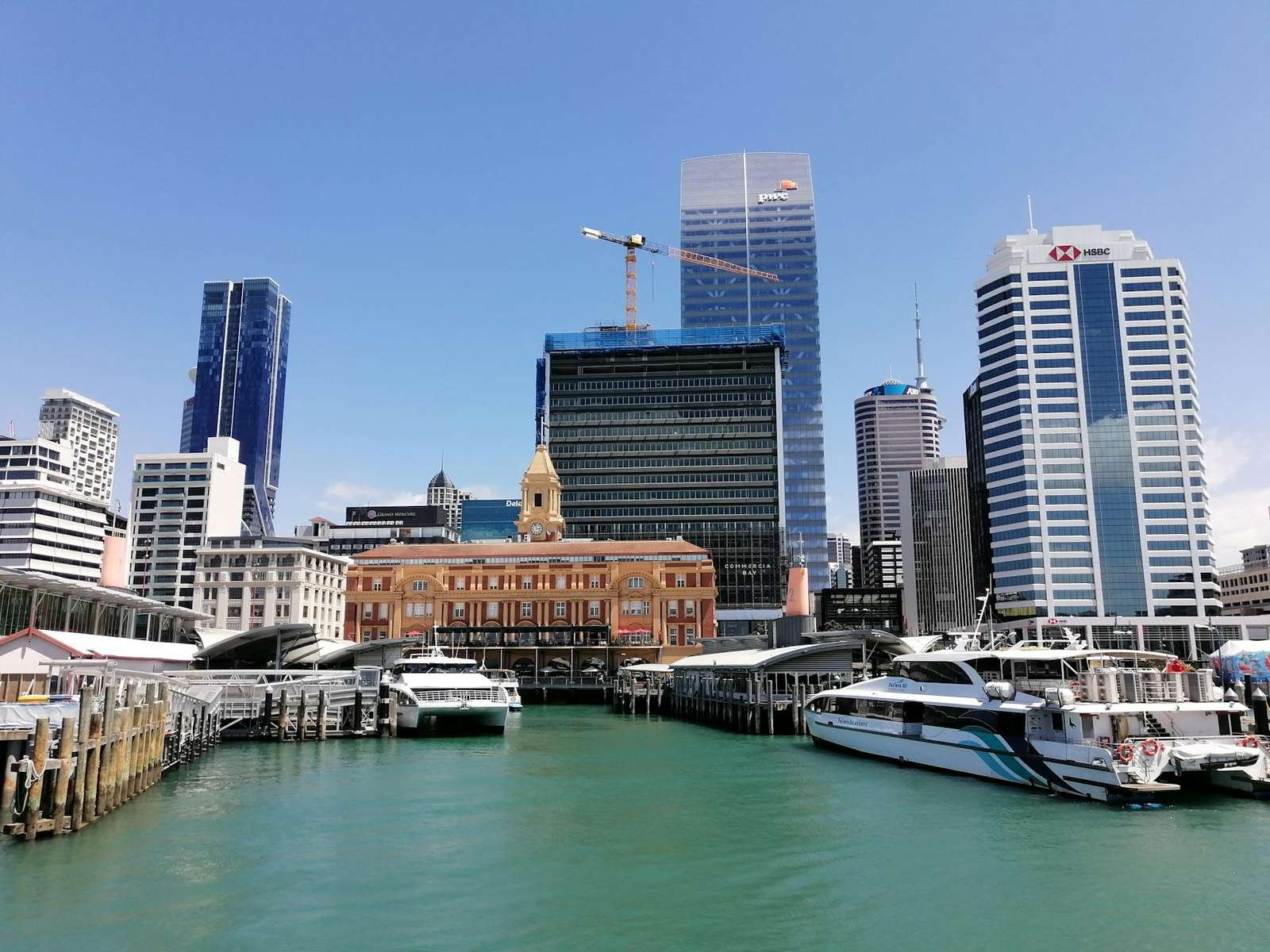
The later 1800s were good to Auckland. Gold in the Coromandel and at Thames, kauri timber logged out of the northern forests, and kauri gum dug from the ground and shipped overseas all fed the economy, and the port stayed busy throughout. The grand Victorian and Edwardian buildings you still see around the central city — banks, warehouses, churches, the old Ferry Building on the waterfront — date from this confident era.
Most of that building stock is gone, but not all of it. We have walked the survivors and written them up in a guide to Auckland’s heritage buildings, including the ones you can only see from the footpath.
The population climbed steadily through these decades, and the town spread out along the new tram and rail lines into suburbs that are now firmly inner-city. Ponsonby, Parnell and Grey Lynn all took shape in this period, which is why their villas look the way they do. If you like poking around old neighbourhoods, the Auckland Neighborhoods Guide 2026: Where to Stay, Eat & Explore reads them through that heritage lens.
Modern Auckland (1900-2000)
Becoming a Pacific city
The 20th century reshaped who Aucklanders were. From the 1950s and 60s, large-scale migration from Pacific nations — Sāmoa, Tonga, the Cook Islands, Niue and Fiji among them — transformed the city, so much so that Auckland is now often described as the largest Pacific city in the world. Add later waves of Asian migration and Auckland became the most diverse city in the country by a wide margin.
You feel that shift everywhere now, from the Pasifika languages spoken in South Auckland to the food. The city’s Polynesian and later Asian communities changed what and how Auckland eats, and you can taste the whole migration story in an afternoon of grazing — the Auckland Food & Drink Guide 2026: Best Restaurants, Cafes & Bars is the practical companion to that. The annual Pasifika Festival, one of the largest Pacific cultural gatherings anywhere, grew directly out of this history and is worth planning a trip around if the timing works.
The Harbour Bridge and the spreading suburbs
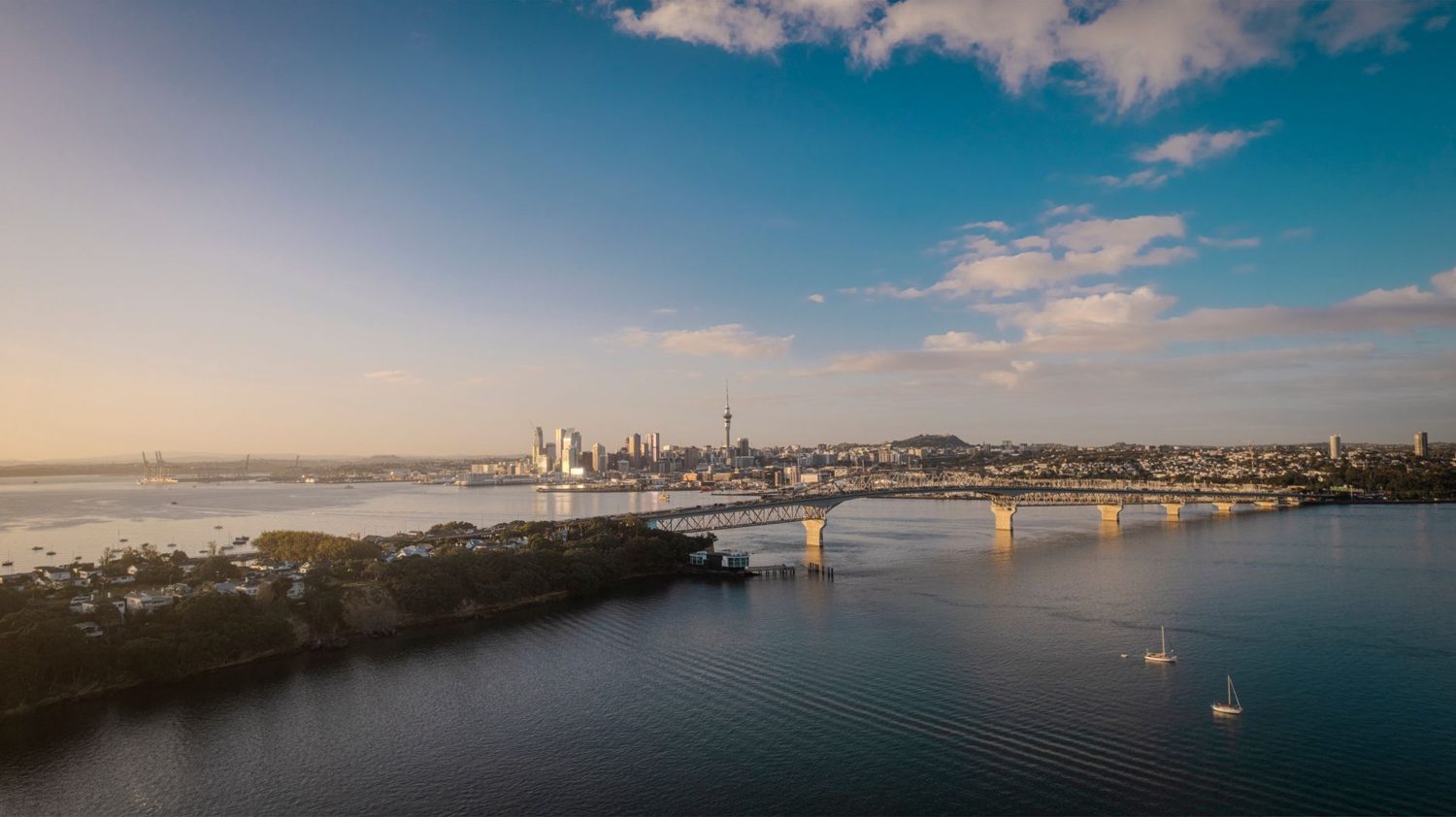
The Auckland Harbour Bridge opened in 1959, finally connecting the central city to the North Shore and unleashing decades of suburban sprawl. Within a few years demand had already outgrown it, and the famous “Nippon clip-ons” — extra lanes fabricated in Japan — were added in 1969. If you have ever sat in Auckland traffic, you have felt the long tail of that mid-century growth.
Bastion Point
One episode you should know about is the Bastion Point occupation of 1977-78. Ngāti Whātua Ōrākei occupied Takaparawhau (Bastion Point) for 506 days to protest the sale of ancestral land, ending in a mass eviction. It became a landmark moment in New Zealand’s land-rights movement and eventually fed into a Treaty settlement that returned land and recognition to the hapū. You can visit the site today; it is quiet, moving, and central to understanding modern Auckland.
The Sky Tower
The Sky Tower opened in 1997 and instantly became the city’s defining landmark, still the tallest freestanding structure in New Zealand. It marks the point where Auckland started confidently rebranding itself as a modern destination. If you plan to go up it, the Sky Tower Auckland: Tickets, Tips & What to Expect in 2026 guide covers the practicalities.
21st-century Tāmaki Makaurau
The biggest structural change of the modern era came in 2010, when the eight separate councils of the metropolitan area were merged into a single Auckland Council — the “Super City.” The idea was to plan a fast-growing region of well over 1.5 million people as one place rather than eight squabbling ones. Growth has been the dominant theme ever since: a light-rail debate that never quite ends, the City Rail Link tunnelled beneath downtown, and a housing market that has tested the city hard.
Alongside that, te reo Māori and Tāmaki Makaurau as a name have moved firmly back into everyday use, and mana whenua have a far more visible role in how the city presents itself, including in the Māori cultural experiences you can now book here, several of which are led by Ngāti Whātua Ōrākei themselves. It is a different Auckland from the one I first got to know, and mostly for the better.
People who shaped the city
History is easier to hold onto through the people in it, so here are a few names worth knowing before you visit:
- Apihai Te Kawau — the Ngāti Whātua Ōrākei leader who signed Te Tiriti and made the tuku of land that became downtown Auckland. His decision shaped everything that followed on this isthmus.
- William Hobson — the first Governor of New Zealand, who chose the Waitematā for his capital and named the town after Lord Auckland. He died in office in Auckland in 1842.
- John Logan Campbell — often called the “father of Auckland,” an early merchant who did well in the young town and later gifted Maungakiekie (One Tree Hill) and its surrounding parkland to the public.
- Joe Hawke — a leader of the Bastion Point occupation in the 1970s, later a member of Parliament, and a central figure in the modern land-rights story.
Māori place names and what they tell you
Once you learn a few of these, the map of Auckland starts reading like a history book. Almost every “maunga” (mountain) name carries meaning:
- Tāmaki Makaurau — “Tāmaki desired by many,” the isthmus itself.
- Waitematā — the northern harbour, often read as “the obsidian waters,” for the way the surface glitters.
- Maungawhau — Mt Eden, “the mountain of the whau tree.”
- Maungakiekie — One Tree Hill, named for the kiekie vine that once grew there.
- Ōrākei — the bayside area, home of Ngāti Whātua Ōrākei.
- Rangitoto — the young volcanic island, linked to a story of blood and sky, “bloody sky.”
You will see many of these names dual-labelled on signage now, English and te reo side by side, which is part of how modern Auckland is reckoning with its history rather than papering over it.
Where to stand in the history
Reading about this is fine, but Auckland rewards going and looking. A few places I send people to:
- Auckland War Memorial Museum — the Māori Court and Pacific galleries are closed, so check gallery access with the museum before you go. The Māori Cultural Experience still runs, and the building itself is a piece of 20th-century history. The Auckland Museum Māori Exhibits Guide (2026) breaks down what to prioritise.
- Maungawhau (Mt Eden) and Maungakiekie (One Tree Hill) — the clearest, most accessible pā terraces in the city, with knockout views as a bonus.
- Takaparawhau (Bastion Point) — for the modern land-rights story and a fine harbour outlook.
- The central city heritage streets — High Street, Vulcan Lane and the waterfront hold most of the surviving Victorian fabric. For a structured walk, see the Auckland Colonial History: Heritage Sites & Walking Tours (2026) guide.
If you would rather build a themed day out of these, the 65 Best Things to Do in Auckland (2026): An Insider’s Guide and the broader Auckland Travel Guide 2026: The Complete Visitor’s Handbook will help you slot them around everything else.
A history-minded day in Auckland
Here is a route I have run more than once and would happily do again. Start early at the Auckland War Memorial Museum, before the tour buses, and give the Māori Court a proper hour. Walk down through the Domain, one of the oldest parks in the country, sitting in an old volcanic crater. Head into the central city for lunch and a slow loop of the Victorian streets, then finish on Maungawhau in the late afternoon light with the whole isthmus laid out below you — two harbours, dozens of cones, and roughly 700 years of decisions in one view.
If you want to figure out how to move between those stops without a car, the Getting Around Auckland: The Complete 2026 Transport Guide is genuinely useful, and for basing yourself somewhere central the Where to Stay in Auckland: Best Neighbourhoods & Hotels for 2026 guide has you covered.
Key dates in Auckland’s timeline
If you just want the skeleton of the whole thing, here it is in order:
| Year | Milestone |
|---|---|
| c. 1350 | Māori settle the Tāmaki isthmus |
| c. 1600-1750 | Fortified pā built and gardened across the cones |
| 1769 | James Cook charts the New Zealand coast |
| 1840 | Treaty of Waitangi signed; Auckland founded |
| 1841 | Auckland becomes the capital of New Zealand |
| 1865 | Capital moves to Wellington |
| 1959 | Auckland Harbour Bridge opens |
| 1977-78 | Bastion Point occupation |
| 1997 | Sky Tower opens |
| 2010 | Auckland Council (“Super City”) formed |
These are the pegs I hang everything else on, and they line up neatly with the 25 Best Day Trips from Auckland in 2026 (With or Without a Car) if you want to chase some of this history out into the wider region — the Waikato battle sites and Coromandel goldfields are both a comfortable drive away.
Frequently Asked Questions
When was Auckland founded?
Colonial Auckland was formally established in September 1840, shortly after the signing of the Treaty of Waitangi, on land gifted by Ngāti Whātua on the Waitematā Harbour. Māori, of course, had settled the isthmus roughly 500 years earlier, around 1350.
What does Tāmaki Makaurau mean?
It is usually translated as “Tāmaki desired by many.” Tāmaki was the Māori name for the isthmus, and “makaurau” reflects how many groups wanted this resource-rich, strategically pinched piece of land between two harbours.
Was Auckland ever the capital of New Zealand?
Yes. Auckland was the capital from 1841 to 1865. The seat of government then moved to Wellington, which sat more centrally for South Island members of Parliament who had to travel by ship. Wellington has been the capital ever since.
How many volcanoes is Auckland built on?
Around 53 volcanic centres make up the Auckland Volcanic Field. They are all dormant rather than active, but the field itself is considered young and technically capable of future activity. Rangitoto, the most recent, is only about 600 years old.
Where can I learn more about Auckland’s Māori history in person?
Start with the Auckland War Memorial Museum’s Māori galleries, then walk the pā terraces on Maungawhau or Maungakiekie. For the fuller picture, the Auckland Māori Culture, History & Heritage: The 2026 Visitor’s Guide pulls the sites and stories together.
Final thoughts
What I love about Auckland’s history is how present it is. You are never far from it here — a terraced cone above the suburbs, a gifted parcel of harbour land that became a downtown, a name that records a centuries-old competition for exactly the ground you are standing on. Learn a little of it before you visit and the city stops being just a skyline and a harbour, and starts being a place with 700 years of argument, adaptation and belonging behind it. Go and stand on a cone at sunset. You will get it.
Last updated: July 2026. Written by the Auckland Tourism Guide team.
Photo credits
- Photo: Ollie Craig via Pexels
- Photo: Ryan Fatalla via Pexels
The story in this guide begins, in a sense, three hours north. Te Tiriti o Waitangi was first signed at Waitangi, and Auckland took over as capital from Russell, across the bay. Both are an easy drive away, and our Auckland to Bay of Islands road trip guide covers the route, the Treaty Grounds and the historic buildings of Russell and Kerikeri.