Auckland Volcanoes: Geological History & 53 Volcanic Cones (2026)
A guide to Auckland's volcanoes: the geological history of the 53-cone field, the best maunga to climb, whether it will erupt again, and how to visit.
This article contains advertising. Our booking links are routed through a partner that adds commission tracking automatically, so if you book through one we earn a commission from the provider, at no extra cost to you. It never affects what we recommend. Affiliate disclosure
The first time I really understood Auckland, I was standing in the grassy crater of Maungawhau at dawn, looking out over a city that spreads across dozens of old volcanoes without seeming to notice it’s doing so. Once you see it, you can’t unsee it. Every hill you climb is a cone. Every round lake is a crater. The whole city is built on a field of volcanoes that is not extinct, only sleeping.
This is the strange, brilliant fact at the centre of Auckland: it’s the only major city in the world built directly on top of an active volcanic field. Understanding that geology is, genuinely, the key to understanding the place.
The short answer
Auckland sits on the Auckland Volcanic Field, a cluster of around 53 volcanoes spread across roughly 360 square kilometres. The field first erupted about 193,000 years ago and last erupted around 600 years ago, forming Rangitoto. It’s classified as active, not extinct, but a future eruption would give days to weeks of warning. Most cones are now public parks you can walk.
Auckland’s volcanoes at a glance
| Feature | Detail |
|---|---|
| Field name | Auckland Volcanic Field (Ngā Tapuwae ō Mataaho) |
| Number of volcanoes | Around 53 separate volcanic centres |
| Area covered | Roughly 360 square kilometres across the isthmus and harbours |
| Oldest / first eruption | About 193,000 years ago |
| Youngest volcano | Rangitoto, around 600 years old |
| Highest cone on land | Maungawhau / Mount Eden, 196m |
| Volcano type | Basaltic, monogenetic (each cone erupts once) |
| Current status | Active, closely monitored by GeoNet |
What is the Auckland Volcanic Field?
The Auckland Volcanic Field, known in te reo Māori as Ngā Tapuwae ō Mataaho, is a monogenetic basaltic field that sits underneath much of metropolitan Auckland. It contains around 53 separate volcanic centres scattered across the isthmus and the surrounding harbours, forming the hills, lakes and basins that give the city its shape.
Two words do a lot of work there, so they’re worth unpacking. “Basaltic” means the magma is low in silica, relatively runny, and generally less explosive than the sticky, gas-rich magma behind volcanoes like Ruapehu or the Taupō supervolcano further south. “Monogenetic” means each volcano typically erupts once and then dies. The next eruption, whenever it comes, builds a brand-new volcano somewhere else in the field rather than reactivating an old one.
That single detail is what makes Auckland so unusual. A “classic” volcano has one vent that erupts again and again over its lifetime. Auckland instead has a diffuse pool of basalt magma sitting deep beneath the city, which occasionally finds a fresh route to the surface and erupts in a new spot. Every cone, crater and lake you see is the scar of a separate visit from that same underground source.
The geological history: nearly 200,000 years of fire
Geologists have dated most of the field’s centres, and the picture that emerges is one of long, uneven pulses rather than steady activity. The first eruptions began about 193,000 years ago. The most recent, the one that built Rangitoto, happened only around 600 years ago, comfortably within the era of Māori settlement.
The pace hasn’t been even. More than half of Auckland’s volcanoes formed in the last 60,000 years, and there are roughly 19 known eruptions within the last 20,000 years. In other words, the field has grown busier, not quieter, in geologically recent times, which is part of why it’s taken so seriously today.
Individual eruptions have lasted anywhere from a few weeks to several years. With the notable exception of Rangitoto, no volcano in the field is known to have erupted more than once. Each build-up of magma finds its own path, punches through the crust, constructs a cone or blasts out a crater, and then falls silent for good.
The many faces of the field: volcanic landforms
For such a compact area, the field is remarkably varied. Walk around Auckland and you’ll encounter several distinct volcanic landforms, each formed by a different kind of eruption.
Scoria cones
The most common and most recognisable, these are the steep, rounded hills that dot the isthmus, built up from frothy, gas-charged lava thrown out and piled around a vent. Maungawhau (Mount Eden), Maungakiekie (One Tree Hill) and Ōwairaka (Mount Albert) are classic examples, and they’re what most people picture when they think of Auckland’s volcanoes.
Maars and tuff rings
When rising magma hits groundwater, the result is a violent, steam-driven explosion that blasts out a wide, shallow crater called a maar, often ringed by a low circular ridge of ash and rock known as a tuff ring. Many of Auckland’s round lakes and basins are flooded maars: Lake Pupuke, the Ōrākei Basin, Pukekawa in the Auckland Domain, and Onepoto. That perfect circle of Lake Pupuke on the North Shore is a textbook example.
Lava flows, caves and shields
The field has produced voluminous lava flows that spread across much of the isthmus, hardening into the rock that underlies large parts of the city. As those flows cooled, some formed lava caves, more than 50 lava tubes have been discovered around Auckland, including the roughly 290-metre Wiri Lava Cave. And the broad, gently sloping profile of Rangitoto marks it as a lava shield, a different beast again from the steep scoria cones on the mainland.
The volcanoes worth climbing
Most of Auckland’s cones are now public parks, freely accessible, and several offer some of the best views in the country. Here are the ones I’d point any visitor toward.
Maungawhau / Mount Eden
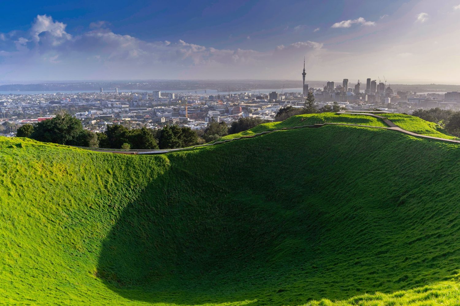
Auckland’s highest natural point at 196m and its most-visited volcano. Maungawhau is a beautifully preserved scoria cone, actually two overlapping cones that erupted in close succession about 28,000 years ago, with a deep, grass-lined crater and 360-degree views over the city, the harbour and out to Rangitoto. It’s free, and access is on foot only now (cars no longer drive to the summit), so allow around 30 minutes for the walk up. The crater itself is sacred and you’re asked not to enter it. The address is 250 Mount Eden Road, a short trip from the CBD, and it pairs naturally with a stay in the surrounding village, which our Mt Eden Maungawhau summit walk guide covers in full.
Rangitoto Island
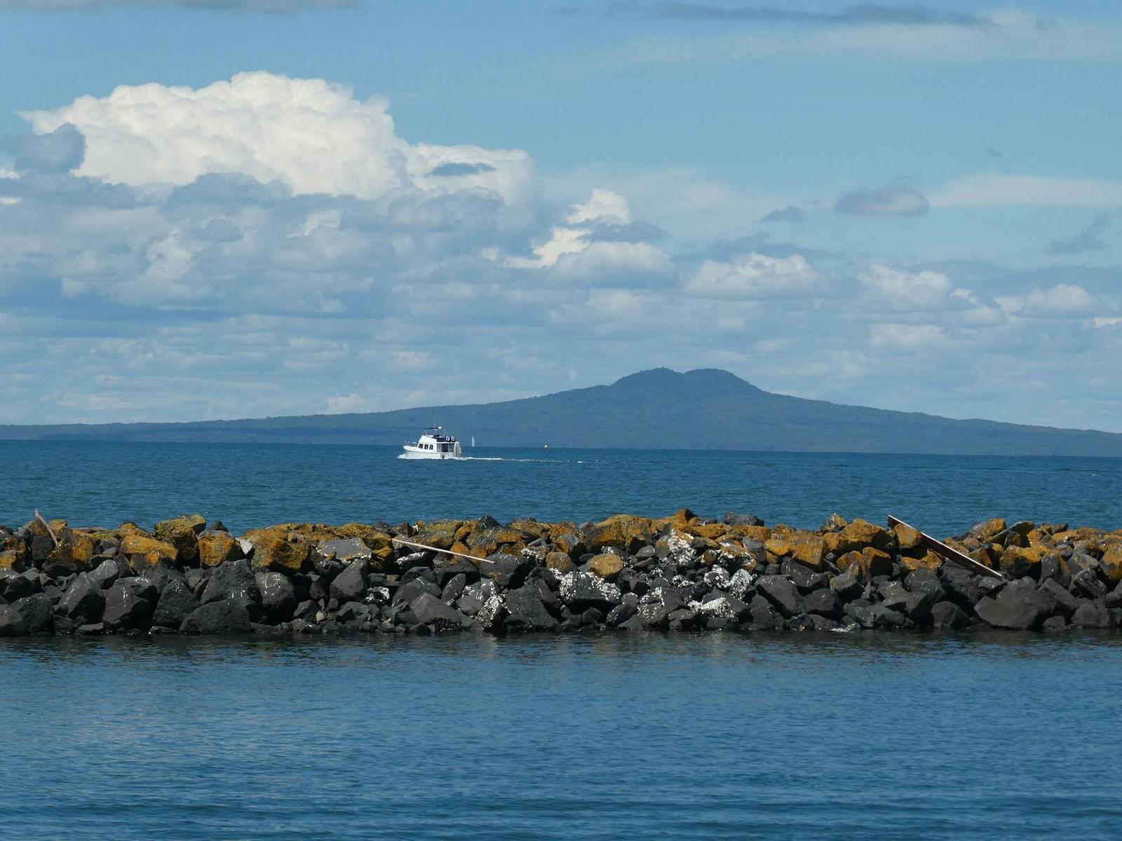
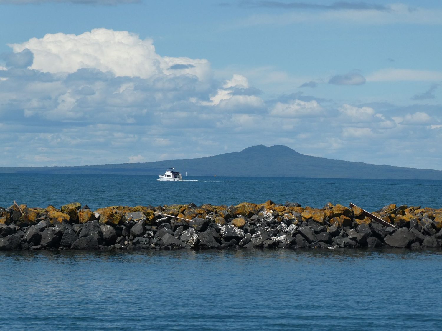
The youngest, largest and most iconic of them all, rising to 260m out of the Hauraki Gulf. Rangitoto erupted around 600 years ago, and unusually in two phases perhaps only a few years apart, making it the one volcano in the field known to have erupted more than once. Its symmetrical silhouette is the classic Auckland skyline view. You reach it by ferry from the downtown waterfront, and the summit track takes about three hours return across raw, black lava fields, so closed-toe shoes are essential. There’s no shop and no water on the island, so bring your own.
Maungakiekie / One Tree Hill
A 182-metre cone at the heart of Cornwall Park, wrapped in one of Auckland’s best-loved green spaces. Its lava flows spread in all directions toward Onehunga, covering around 20 square kilometres and making it the second-largest volcano in the field by area after Rangitoto. The summit carries a tall obelisk and offers a relaxed, sheep-dotted walk of around 45 minutes, and the terraced earthworks of its old pā become strikingly visible in low afternoon light. It erupted roughly 67,000 years ago.
Mount Victoria and North Head, Devonport
Two smaller cones across the harbour in Devonport, easily combined with a ferry ride. Mount Victoria gives quick, panoramic views, while North Head hides a warren of WWII tunnels and gun emplacements beneath its volcanic slopes. Together they make a rewarding half-day, and Devonport itself is a lovely village to eat in afterward.
Lake Pupuke
Not a hill but a hole: a freshwater lake filling a maar crater on the North Shore, ringed by a flat, easy loop walk of around 45 minutes. It’s the field’s oldest dated feature, at roughly 200,000 years, and a gentle counterpoint to the summit climbs.
The maunga are sacred: visiting with respect
Auckland’s volcanic cones are not just geological curiosities or scenic lookouts. To Māori, many are Tūpuna Maunga, ancestral mountains, and they carry deep historical, spiritual and cultural significance. Most were the sites of substantial pā (fortified settlements) long before European arrival, used for living, gardening, ceremony, birth and burial, and their terraced slopes still bear the marks of that history.
In 2014, through a Treaty of Waitangi settlement, ownership of 14 Tūpuna Maunga was returned to Ngā Mana Whenua o Tāmaki Makaurau, the mana whenua tribes of Auckland, which include Ngāti Whātua among others. If you want that history told by the people whose ancestors shaped these cones, our guide to Māori cultural experiences in Auckland lists the mana whenua-led maunga tours worth booking. These maunga are now co-governed by the Tūpuna Maunga o Tāmaki Makaurau Authority, made up equally of representatives from the Tāmaki Collective and Auckland Council.
What this means for you as a visitor is simple and worth honouring. The summits and crater rims are treated as tapu (sacred): stay on the formed tracks, don’t enter the craters, and treat the maunga as the living taonga they are. Access can occasionally be restricted for cultural reasons or events. It costs you nothing and it matters a great deal. If you’d like to understand the culture behind these places more fully, our Auckland Māori culture, history and heritage guide is the place to start.
Will Auckland erupt again?
Yes, eventually. This tends to unsettle first-time visitors, so let me be clear about what it does and doesn’t mean. The Auckland Volcanic Field is officially classified as active rather than extinct, and geologists agree it will erupt again at some point in the geological future. What they can’t tell you is where, when, or how large, because each eruption builds a new volcano in a new place.
The reassuring part is the warning. GeoNet, New Zealand’s geological hazard monitoring network, runs a permanent array of seismographs and ground sensors around Auckland. A new eruption would be preceded by detectable seismic activity, magma forcing its way toward the surface, and the expected warning window is days to weeks, not minutes. There’s a well-developed contingency plan, including defined evacuation zones, should an eruption ever look imminent.
Statistically, the next eruption could come tomorrow or thousands of years from now. Decades of study by Auckland University researchers and GNS Science have made this one of the best-understood volcanic-hazard settings of any major city on Earth. For a visitor, the practical risk on any given day is effectively nil, the cones are attractions, not danger zones.
How to explore the volcanoes: routes and itineraries
You can build a great day, or several, around Auckland’s volcanoes without much planning. Here’s how I’d approach it.
Best short walks
For a quick hit of the spectacular, the Maungawhau (Mount Eden) summit walk is about 30 minutes return and hard to beat for the views. Maungakiekie (One Tree Hill) and Cornwall Park make a relaxed 45-minute wander among sheep and monuments. The Lake Pupuke loop is a flat, easy 45 minutes. And in Devonport, combining Mount Victoria and North Head, with the WWII tunnels, fills a satisfying few hours off the back of a ferry.
The committed hike
The Rangitoto Summit Track is the big one, around three hours return over rough lava, rewarded with a sweeping view back across the gulf to the city. Wear proper shoes, carry water and sun protection, and check the ferry times both ways so you don’t get stranded.
The Coast to Coast Walkway
If you want to string several volcanoes together, the Coast to Coast Walkway is a 16km signposted route crossing the isthmus from the Waitematā Harbour to the Manukau Harbour, passing over or near Maungawhau, Maungakiekie, Ōwairaka (Mount Albert) and Puketāpapa (Mount Roskill). Allow four to five hours and carry water, as refill points are limited. It’s a proper day out and a fine way to feel the volcanic shape of the city underfoot.
A volcano day, start to finish
My favourite full day looks something like this: begin at the Auckland War Memorial Museum’s volcanic-field exhibit for context, then climb Maungawhau late morning, walking back down through Newton and K Road if you want to take in the murals on Auckland’s street art trail on the way. Lunch in Cornwall Park, then walk Maungakiekie. Catch a mid-afternoon Rangitoto ferry from downtown, and finish back in the city with dinner overlooking the harbour and that unmistakable Rangitoto silhouette. For more ways to fill the surrounding days, our 65 best things to do in Auckland and best day trips from Auckland guides both dovetail nicely with a volcano-themed visit.
How the volcanoes shaped the modern city
It’s easy to treat the cones as scenery, but the field did far more than provide viewpoints. It built the ground Auckland stands on and quietly dictated where and how the city grew.
The lava flows that spread across the isthmus created fertile, free-draining soils, which is exactly why Māori built extensive gardens and pā on and around the maunga, and why the terraced slopes of places like Maungakiekie are so elaborate. Those same volcanic soils later made the isthmus productive farmland before the suburbs arrived.
The rock itself became building material. For over a century, Auckland quarried its own volcanoes for scoria and basalt to make roads, walls and buildings, and several cones were partly or heavily quarried away before their cultural and geological value was recognised and protection put in place. Some smaller centres in the field were flattened almost entirely, which is part of why the exact count of “53” comes with a little uncertainty, a few were lost or buried before they could be properly recorded.
The craters and maars gave the city its lakes and basins, natural amphitheatres and freshwater bodies right in the middle of the suburbs. And the harbours themselves, framing so many Auckland views, were shaped in part by this volcanic and geological history. When you stand on a summit and look out, almost everything in the frame, the parks, the lakes, the shape of the coast, traces back in some way to the field beneath your feet.
Auckland’s volcanoes by age
Dating the field has been decades of painstaking work, and the spread is enormous, from features around 200,000 years old to the 600-year-old newcomer. A rough timeline of some well-known sites helps put it in perspective.
| Volcano | Approximate age | Note |
|---|---|---|
| Lake Pupuke | ~200,000 years | Among the oldest dated features (a maar) |
| Maungakiekie / One Tree Hill | ~67,000 years | Second-largest in area after Rangitoto |
| North Head | ~50,000 years | Later fortified with WWII tunnels |
| Maungawhau / Mount Eden | ~28,000 years | Highest point on the mainland at 196m |
| Maungarei / Mount Wellington | ~9,000 years | One of the larger scoria cones |
| Rangitoto | ~600 years | Youngest, and the only twice-erupted cone |
The takeaway isn’t the individual dates so much as the pattern: activity clustered heavily toward the recent past, with more than half the field forming in the last 60,000 years. Rangitoto, at a mere six centuries, is a reminder that this is a living landscape, not a fossil one.
Where to learn more: museums and centres
If the geology grabs you, a few places bring it to life, and if the landscape itself does, the cones and Rangitoto recur through the New Zealand painting hanging in Auckland’s best public and dealer galleries. The Auckland War Memorial Museum has a strong section on the volcanic field, with 3D models, lava samples and interactive displays (admission is around NZ$28). The Stardome Observatory at One Tree Hill covers Auckland’s geology alongside astronomy (around NZ$18). And on Rangitoto itself, a self-guided heritage trail carries interpretation panels at the key viewpoints, so you can read the landscape as you cross it.
Practical tips for visiting the volcanoes
A few things I’ve learned the hard way. Wear shoes with grip: the grass slopes of Maungawhau and Maungakiekie get genuinely slippery after rain, and Rangitoto’s lava is unforgiving on soft soles. Carry water and sun protection, the summits are exposed and there’s little shade. Time your photography: Maungawhau at sunrise catches the light over the city, Rangitoto is at its best as a sunset silhouette from the waterfront, and One Tree Hill’s earthworks emerge in low afternoon sun.
Getting around is easy enough. Many cones are reachable by public transport, and the offshore ones by ferry, our getting around Auckland transport guide covers the buses, trains and ferries you’ll want. And because so many of these sites sit right beside the coast, it’s easy to pair a volcano morning with an afternoon at the shore, which is exactly what our Auckland beaches and outdoor adventures guide is built for.
If you’d rather trade summits for coastline for a day, Auckland’s beaches make an easy companion to any volcano itinerary. The calm eastern bays like Takapuna Beach sit close to the North Shore cones, while the dramatic black-sand west coast, Piha, Karekare and Bethells Beach (Te Henga), offers a wilder, windswept contrast to the tidy parkland cones of the isthmus. It’s the same restless geology, just showing a different face.
Frequently Asked Questions
How many volcanoes are in Auckland?
Around 53 separate volcanic centres make up the Auckland Volcanic Field. They range from tiny vents to substantial cones like Maungawhau (Mount Eden) and Rangitoto, spread across roughly 360 square kilometres of the isthmus and its harbours.
Is the Auckland Volcanic Field still active?
Yes. It’s classified as active rather than extinct, the most recent eruption, Rangitoto, was only about 600 years ago. Future eruptions are expected at some unknown point, but they would be preceded by days to weeks of detectable warning signs, and the field is closely monitored by GeoNet.
What is the youngest volcano in Auckland?
Rangitoto Island, which erupted around 600 years ago in two phases and is the only volcano in the field known to have erupted more than once. Its symmetrical cone is the most recognisable feature of the Auckland skyline.
Can you visit Auckland’s volcanoes?
Yes, most are public parks. Maungawhau (Mount Eden), Maungakiekie (One Tree Hill), Mount Victoria, North Head, Lake Pupuke and Rangitoto are all freely accessible, with summit walks ranging from about 30 minutes to three hours. Many are sacred maunga, so stay on the tracks and don’t enter the craters.
What is the highest volcano in Auckland?
Maungawhau (Mount Eden) at 196m is the highest natural point on the Auckland mainland. Rangitoto reaches 260m, but it sits offshore in the Hauraki Gulf. Maungakiekie (One Tree Hill) is another of the taller cones at 182m.
Final thoughts
Auckland’s volcanic geology isn’t a footnote to the city, it’s the organising fact behind it. Every harbour was shaped by fire, every great viewpoint sits on a cone, and many of the parks Aucklanders picnic in are old craters. Spend a morning in the crater of Maungawhau, an afternoon crossing Rangitoto’s lava, and you’ll never look at the skyline the same way again.
Come with good shoes, water, and a bit of respect for the maunga as sacred places, and Auckland’s volcanoes will give you some of the finest, and most quietly astonishing, walks of any city on earth. To weave them into a wider trip, start with our complete Auckland travel guide.
Last updated: July 2026. Written by the Auckland Tourism Guide team.
Photo credits
- Photo: Anna Bakker via Pexels
- Photo: Ryan Fatalla via Pexels