Mt Eden Auckland: Maungawhau Summit Walk Guide (2026)
The Mt Eden summit walk takes about 20 minutes up Maungawhau (196m), the highest point on the Auckland isthmus, for a free 360-degree view. Trails, crater, history.
This article contains advertising. Our booking links are routed through a partner that adds commission tracking automatically, so if you book through one we earn a commission from the provider, at no extra cost to you. It never affects what we recommend. Affiliate disclosure
The easy mistake on Maungawhau is turning around too early. Two-thirds of the way up the sealed path, the city is already spread out below you and it feels like the view. Keep going: at the crater rim the whole Auckland isthmus opens out in every direction. Allow about twenty minutes for the climb. It is, without much competition, the best free thing you can do in this city on a clear day.
Mt Eden is the English name. Maungawhau is the older one, and the one you will increasingly see on signs, maps and at the maunga itself. It means “hill of the whau tree,” and it is pronounced roughly mow-nga-foe. This guide uses both names, leaning on Maungawhau, and the cultural weight of the place is a big part of why it is worth your time.
The short answer
The Mt Eden summit walk is a short, sealed climb to the top of Maungawhau (196 metres), the highest natural point on the Auckland isthmus. Allow about 20 minutes to walk up from the visitor car parks. It is free, and the top delivers a full 360-degree view of the city, the harbours and the Hauraki Gulf. The summit road is closed to private cars, so most visitors walk up.
Mt Eden at a glance
| Detail | What to know |
|---|---|
| Māori name | Maungawhau (“hill of the whau tree”) |
| Height | 196 metres — the highest natural point on the Auckland isthmus |
| Walk time | About 20 min up to the summit; allow longer to walk the crater-rim boardwalk |
| Paths | Formed paths to the summit and a boardwalk around the crater rim |
| Cost | Free |
| Vehicle access | Summit closed to private cars since January 2016 (walk up) |
| Opening hours | Summer 7am–8.30pm; winter 7am–7pm (main gate) |
| Address | 250 Mount Eden Road, Mount Eden |
| Crater | 180 m across, 50 m deep — sacred (tapu), viewed from the rim only |
| Managed by | Tūpuna Maunga Authority |
That’s the frame. Below I’ll walk you through the climb itself, how to get there, the crater and the pā history you’re standing on, when to go, and how to fold it into a good half-day.
Getting to Maungawhau
The maunga sits at 250 Mount Eden Road, south of the city centre. You’ve got a few ways in, and none of them are hard.
By train and bus
The train is the tidy option. Maungawhau station, where Mt Eden station used to be, is on the East West Line, a short ride from Waitematā Station (Britomart) now that trains run through the City Rail Link, and from the station it’s a walk of ten to fifteen minutes to the base of the maunga. Tap on and off with an AT HOP card or a contactless card; adult fares start at NZ$3.00 for one zone, and AT’s Journey Planner shows the fare for your trip. The Outer Link bus also loops past, stopping near the maunga a short walk from the entrance. If you’re weighing up transport options generally, our guide to getting around Auckland lays out the HOP card and the bus and train network in full.
By car
Here’s the thing people get caught out by: you can’t simply drive to the summit. The summit road closed to private cars, motorbikes and scooters in January 2016, the first of Auckland’s ancestral mountains to go vehicle-free under the Tūpuna Maunga Authority. Walkers and people on pedal bikes still use the road, and there is mobility access for those who need it (see below). So drive to the base, not the top.
There are four visitor car parks: two off the roundabout on Puhi Huia Road (one to the left, one below the old Tea Kiosk building), one in Tahaki Reserve, and one at the Normanby Road playground. Time limits are enforced so that everyone gets a fair shot at a space, which in practice means don’t plan to leave your car there for three hours. It’s a short drive from the CBD (roughly NZ$15 in an Uber), and a taxi or rideshare can drop you at the base.
If you can’t manage the climb
Walking-only doesn’t mean everyone is shut out. If you have limited mobility, or you’re driving someone who does, you can request an access code that opens the automated gate and lets you drive to the tihi. It’s worth arranging in advance rather than turning up and hoping. The upper boardwalk itself is well graded and far kinder to wheels than the old dirt tracks were.
On foot from the city
You can also just walk the whole way from town, up Symonds Street and Mountain Road. It’s mostly gentle uphill, and it threads you through some handsome old inner suburbs. If you’d rather not walk both ways, go up on foot and catch the train back from Maungawhau station.
The summit walk, step by step
From the car parks near the top of the approach, allow about 20 minutes to walk up on a sealed path. It climbs steadily — you’ll feel it in your legs, but there’s nothing technical, no scrambling, no loose ground.
What the climb is actually like
The lower section winds up the western flank with the roofs of Mt Eden Village and the CBD gradually rising into view over your shoulder. It’s pleasant rather than dramatic at first. Then the trees thin out, the open volcanic slopes take over, and the last stretch is where it earns its reputation. You come up onto the boardwalk near the tihi and the crater drops away in front of you almost without warning. That’s the moment worth saving your camera battery for.
The boardwalk
Most of the summit area is now boardwalk, and it’s a genuinely good piece of work. The award-winning first section opened in August 2020, and the extension around the tihi and crater rim opened in June 2023, connecting straight from the car park. It was built because more than a million people a year were visiting and the old dirt tracks were rutting badly and eroding the very features people came to see. The boardwalk sits lightly on the ground — air, water and light pass through it, grass grows underneath, and the whole thing can be recycled at the end of its life. There’s a large ātea (gathering space), platforms and seating with uninterrupted views out to the harbours and the other maunga.
The crater rim
Beyond the summit, formed paths and a boardwalk run around the crater rim, so allow extra time to stop at the top and walk it. If you’re short on time, going straight up and back is quicker; if you’ve got the legs, the rim loop is the part I’d never skip.
What to bring
- Water, especially in summer — there’s no tap at the summit itself
- A light layer or windbreak — the tihi is exposed and the wind up there has a bite even on warm days
- A hat and sunscreen — New Zealand’s UV is fierce, and the summit has no shade
- Comfortable shoes — nothing technical needed, but the sealed path is a real climb
- A camera or a charged phone, obviously
The crater
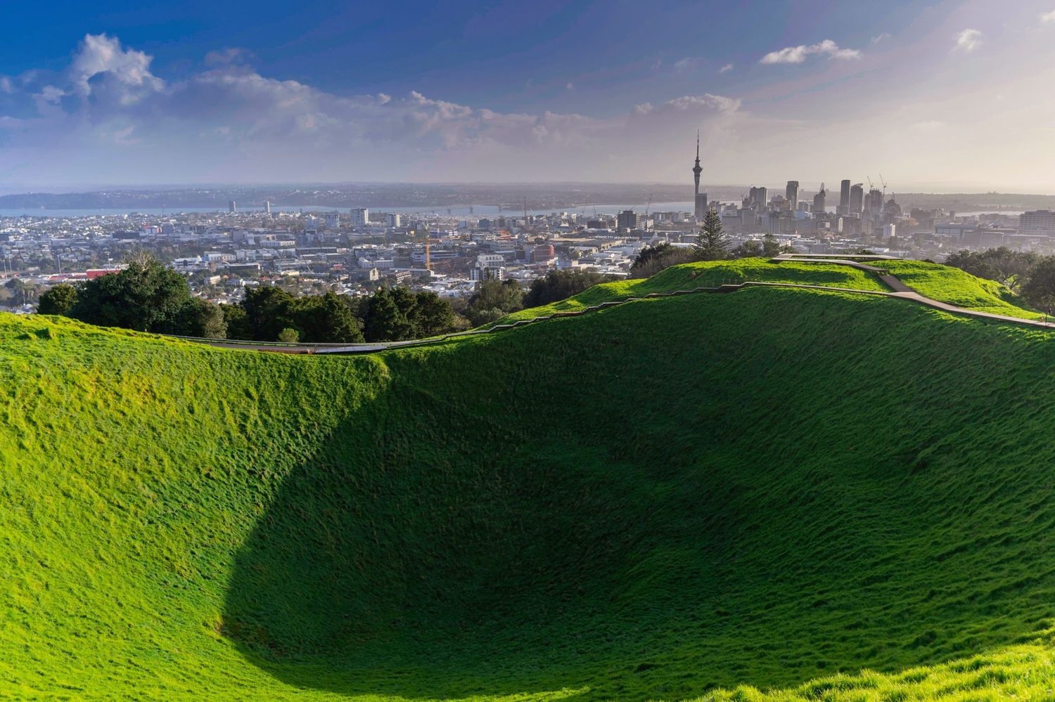
The crater is what makes Maungawhau feel different from just a good lookout. It’s a near-perfect bowl, about 180 metres across and 50 metres deep, lined with grass that turns a startling green after rain. You walk the rim and see it from every angle, the shape shifting as you go.
You’ll notice you can’t walk down into it, and there’s a good reason. The crater is tapu — sacred. In Māori tradition it’s known as Te Kapua kai a Mataoho, the food bowl of Mataoho, the deity held responsible for the volcanic activity that built this landscape. Visitors are asked to stay on the rim tracks and the boardwalk and not enter the bowl. It’s not a fussy rule; it’s the central act of respect the place asks of you, and honestly the view from the rim is better anyway. For more on the stories behind Auckland’s maunga and the wider iwi history, our guide to Auckland Māori culture, history and heritage is a good next read.
The view from the top
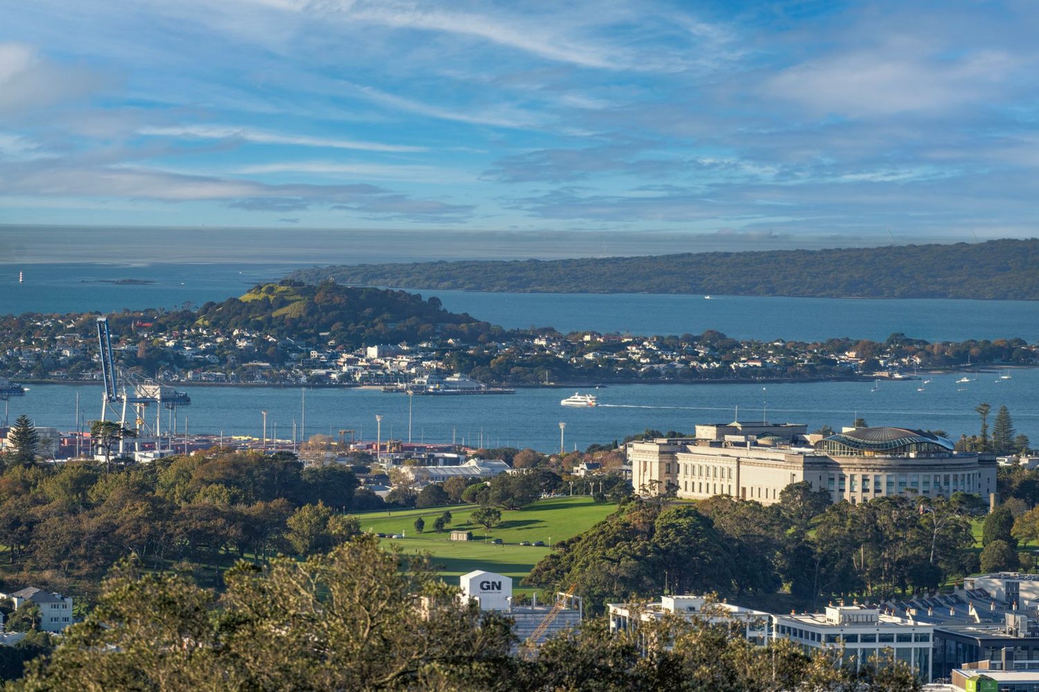
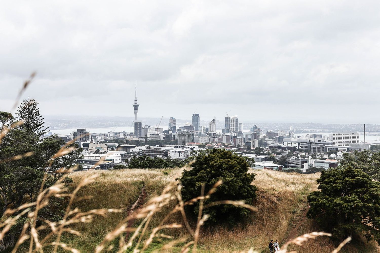
On a clear day the summit gives you the entire Auckland isthmus laid out below, and it’s the kind of view that reorients you — suddenly the geography of the city makes sense. Here’s roughly what you’re looking at:
- North: the CBD and Sky Tower up close, the Waitematā Harbour, the North Shore suburbs of Devonport and Takapuna, and the low symmetrical cone of Rangitoto Island out in the gulf, which makes an easy Rangitoto day trip by ferry if the volcano bug bites
- East: Maungarei (Mt Wellington), the Hauraki Gulf islands, and on a properly clear day the hills of the Coromandel
- South: the southern suburbs, the Manukau Harbour and the Hunua Ranges
- West: the western suburbs rolling toward the dark line of the Waitākere Ranges
If you want to see how the summit view compares with the paid ones, the observation decks at the Sky Tower get you higher and cover the weather-proof angle, but for my money the free 360 from a grassy crater rim wins on atmosphere.
Standing on a pā
The thing that took me a while to properly grasp is that Maungawhau isn’t just a volcano with a nice view. It was one of the largest and most important pā in Tāmaki Makaurau — a citadel built for thousands of people, like nearby Maungakiekie (One Tree Hill). When you look at the terracing cut into the slopes, you’re looking at the last physical remnants of that settlement.
What to look for
- Tūāpapa (terraces): the flat shelves cut into the outer slopes, where houses and gardens once sat. They read most clearly in low, raking morning or late-afternoon light.
- Rua (storage pits): the circular hollows dug on the terraces and around the crater rim, once roofed to store kūmara and other crops. You’ll walk right past several on the rim track.
- Defended crests: the highest points held a series of strongpoints. Interestingly, there’s no clear evidence of the ditch-and-bank defences you’d normally expect on a major pā, which is unusual and still a bit of a puzzle.
Some of the original earthworks were lost to nineteenth-century quarrying — you can still see the old Batger Quarry scar on the south-western flank — and to the roads, reservoirs and car parks built over the years. But enough remains to trace the shape of the place, and the boardwalk was deliberately routed to protect it.
Who looks after it
In the 2014 Treaty of Waitangi settlement, ownership of Auckland’s 14 Tūpuna Maunga was returned to Ngā Mana Whenua o Tāmaki Makaurau, a collective of the region’s iwi and hapū. The maunga are now co-governed by the Tūpuna Maunga Authority and Auckland Council. That co-governance is why the summit went car-free, why the crater is protected, and why the interpretation you’ll read on site is told from mana whenua perspectives. Maungawhau, along with the other maunga, is on New Zealand’s tentative list for UNESCO World Heritage status.
The education centre and café
Part-way up, in the old kiosk building, you’ll find Te Ipu Kōrero o Maungawhau — a small education centre with a short film and an interactive augmented-reality model that’s genuinely worth ten minutes, especially if you’ve got kids or you want the history to land before you reach the top. The Friend & Whau café shares the building and does coffee and snacks, which makes a handy mid-climb pause. Public toilets are near the tour-bus parking off Puhi Huia Road and at the Normanby Road playground.
When to go
The main entrance gate opens at 7am and closes at 8.30pm in summer and 7pm in winter, with the seasonal times following daylight saving. Within that window, timing changes the experience a lot.
- Sunrise: my favourite. Often near-empty, golden light washing over the city, and cool enough to enjoy the climb. You’ll need to check sunrise times and get there before the gate-to-summit walk.
- Sunset: the most popular slot, and for good reason — the skyline goes to silhouette and the light is lovely. Expect company at the rim, especially on summer weekends.
- Weekday mid-morning: the sweet spot for quiet and comfortable temperatures.
- Summer midday: the one I’d steer you away from. The summit is fully exposed and it gets hot with no shade.
- A clear winter day: underrated. The air is sharp, visibility is enormous, the light is dramatic, and the crowds thin right out.
Doing it with kids
This is one of the easier Auckland outings to do with children. The climb is short and sealed, most prams cope with it, and the payoff — a giant grass bowl and a view over the whole city — tends to land well with younger kids. It’s free, which helps on a family budget, and the augmented-reality model at Te Ipu Kōrero gives restless ones something to do. Fold in a bribe of hot chips or a scoop of ice cream down in the village afterwards and you’ve got a smooth half-day. For more family-friendly planning, our Auckland with kids guide has plenty more in this vein.
Photography tips
- Shoot at the edges of the day. Sunrise and sunset give you the warm light and dramatic skies; harsh midday sun flattens everything.
- Bring something wide. A wide-angle lens (or your phone’s ultra-wide) is the only way to get the full crater and the panorama in one frame.
- Walk the rim before you settle. The composition changes completely as you move around the bowl — scout the whole loop, then pick your spot.
- Catch the terraces in raking light. Late afternoon is when the pā earthworks pop into relief. Midday they nearly vanish.
- No drones. Drones are not permitted on Auckland’s Tūpuna Maunga. Don’t be that person.
Maungawhau vs Maungakiekie (One Tree Hill)
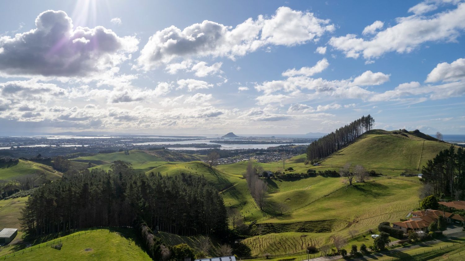
People always ask which of Auckland’s two big volcanic cones to do, and my honest answer is both, if you can — they’re different experiences.
- Maungawhau / Mt Eden: the taller of the two at 196 metres (Maungakiekie is 184), a 360-degree view, a 50-metre-deep crater, and a short, sealed walk. Summit closed to private cars.
- Maungakiekie / One Tree Hill: slightly lower, set within Cornwall Park with its grazing sheep, picnic lawns and mature trees, giving it a more pastoral, spread-out feel.
If you only have time for one, choose Maungawhau for the crater and the view. If you want an afternoon of picnicking and space to roam, One Tree Hill and Cornwall Park is the pick. Both sit within Auckland’s remarkable volcanic field, which our guide to Auckland’s volcanoes and geological history covers in proper depth if the geology grabs you.
Making a half-day of it
Maungawhau pairs naturally with Mt Eden Village, the café strip a short downhill walk from the base. Here’s a loose itinerary that works well:
- Morning coffee in Mt Eden Village to fuel up
- Walk up to the summit (about 20 minutes)
- Loop the crater rim and take your time with the view and the terraces
- Wander back down into the village for brunch or lunch
- Browse the shops — the village has good independent bookshops and homeware stores
- Train or bus back to the city from Maungawhau station
If you’d rather build a fuller day, the maunga slots easily into a wider list of city highlights — our roundup of the best things to do in Auckland and the broader Auckland travel guide will help you stitch it together. Peckish afterwards? The Auckland food and drink guide covers where to eat well nearby.
Other nearby stops
- Mt Eden Village — the café and shopping strip a kilometre downhill from the summit
- Eden Garden — a lush walking garden a few minutes’ drive away, small entry fee
- Auckland Domain and the War Memorial Museum — around ten minutes away, an easy add-on
- Eden Park — Auckland’s main stadium, roughly a kilometre west of the maunga
How Maungawhau fits a wider Auckland trip
The maunga is a city walk, but it sits well alongside Auckland’s coast and countryside. If you’re building an outdoors-leaning itinerary, it’s a natural warm-up before heading to the beaches and ranges — the parent Auckland beaches and outdoor adventures guide covers those in full. The wild west-coast surf beaches like Piha and neighbouring Karekare make a dramatic day trip from the city, while the calmer east-coast options such as Mission Bay and Takapuna are closer and better for a swim. For a black-sand alternative to Piha, Bethells Beach (Te Henga) is worth the drive. If you need somewhere to base yourself, our where to stay in Auckland guide breaks down the neighbourhoods.
What to avoid
- Don’t try to drive to the top. The summit has been car-free since 2016. Park at the base.
- Don’t enter the crater. It’s tapu and off-limits. Stay on the rim and the boardwalk.
- Don’t go off the tracks. The terraces and the replanted native areas are fragile, and staying on-path is how they survive a million visitors a year.
- Don’t fly a drone. Banned across all the Tūpuna Maunga.
- Don’t underestimate the wind. Bring a layer even when it’s warm at the bottom.
Frequently Asked Questions
How tall is Mt Eden?
Maungawhau / Mt Eden stands 196 metres above sea level, which makes it the highest natural point on the Auckland isthmus. It’s a scoria cone that last erupted around 28,000 years ago, and from the summit you get an unbroken view across the city, both harbours and out to the islands of the Hauraki Gulf.
Can you drive up Mt Eden?
Not in a private car. Cars, motorbikes and scooters have been barred from the summit road since January 2016, when Maungawhau became the first of Auckland’s ancestral mountains to go vehicle-free under the Tūpuna Maunga Authority. You park at one of the four base car parks and allow about 20 minutes to walk up. People with limited mobility can request a gate access code to drive to the top.
How long is the Mt Eden summit walk?
Allow about 20 minutes to walk up to the summit on a sealed path from the visitor car parks near the top of the approach. Add time at the top if you want to follow the boardwalk around the crater rim.
Is Mt Eden free to visit?
Yes, entirely free. There’s no admission charge to the maunga and no fee to walk to the summit, and the four base car parks are free too (though time limits are enforced so everyone gets a space). The summit kiosk houses Te Ipu Kōrero o Maungawhau, a small education centre, and the Friend & Whau café if you want a coffee.
Can you go inside the Mt Eden crater?
No. The crater, known as Te Kapua kai a Mataoho, is tapu (sacred) to mana whenua, and visitors are asked to stay on the rim tracks and boardwalk rather than descend into the bowl. It’s the main courtesy the place asks of you, and the truth is the view over the crater from the rim is far better than anything you’d get inside it.
Final thoughts
If you do one free thing in Auckland, make it this. Maungawhau gives you the city’s best panorama, a genuinely striking crater, and a layer of history you can read in the ground under your feet, all for the price of a twenty-minute walk. It’s close to town, it suits almost any fitness level, and it works at dawn, at dusk and on a crisp winter afternoon.
My advice: go early or late for the light and the quiet, walk the full rim loop rather than stopping at the first viewpoint like I did, and give the crater the respect it’s owed. Then wander down into Mt Eden Village for a long brunch. That’s about as good as a half-day in this city gets.
Last updated: July 2026. Written by the Auckland Tourism Guide team.
Photo credits
- Photo: Ryan Fatalla via Pexels
- Photo: Miguel Cuenca via Pexels
- Photo: Belle Co via Pexels
- Photo: Ollie Craig via Pexels