Auckland Without a Car: A Car-Free Itinerary
Auckland without a car after the City Rail Link: trains, ferries and buses, a three-day car-free itinerary, and the honest list of what needs a tour or a hire day.
This article contains advertising. Our booking links are routed through a partner that adds commission tracking automatically, so if you book through one we earn a commission from the provider, at no extra cost to you. It never affects what we recommend. Affiliate disclosure
Auckland has a reputation as a driving city, and for most of its residents that is still true — it sprawls eighty kilometres north to south and it was planned around motorways. But for a visitor the picture is very different, and it changed materially on 13 September 2026 when the City Rail Link opened. Doing Auckland without a car is now not a compromise but, for the majority of trips, the better option: the ferries are the good way to reach the islands rather than the cheap one, the trains reach the neighbourhoods worth eating in, and central parking is expensive enough that a hire car spends most of a city trip costing you money to stand still.
This is a complete car-free plan: what the network actually covers, a three-day itinerary built entirely on public transport and your own feet, an honest list of the places you genuinely cannot reach without a car and what to substitute for them, and the practical mechanics of fares, apps and timetables. Prices and journey times were checked in September 2026 — Auckland Transport’s fares moved during the year, so check current values on at.govt.nz rather than trusting a number in any article, this one included.
At a glance: what you can and cannot reach
| Destination | Car-free? | How |
|---|---|---|
| City centre, waterfront, Domain, Museum | Easily | On foot, plus trains |
| Ponsonby, K Road, Newmarket, Mount Eden, Parnell | Easily | Train or a short bus |
| Devonport, Takapuna, Mission Bay | Easily | Ferry or bus |
| Waiheke, Rangitoto, Tiritiri Matangi | Easily | Ferry — this is the only way anyway |
| Maungawhau, Maungakiekie, the Domain | Easily | Train or bus, then walk |
| Auckland Zoo, Kelly Tarlton’s, MOTAT | Yes | Bus |
| Piha, Karekare, Bethells | No | Tour or taxi only — see below |
| Muriwai gannet colony | Effectively no | Tour |
| Matakana, Goat Island | No | Tour |
| Waitomo, Hobbiton, Rotorua | Yes | Coach tours run from the city |
What the City Rail Link changed
This is the single most important development for car-free visitors in decades, and any guide written before September 2026 is out of date on it.
The CRL opened on 13 September 2026, adding three underground stations and converting Britomart from a dead-end terminus into a through station. The new stops are:
- Te Waihorotiu — mid-Queen Street, in the middle of the city centre, and expected to become the busiest station in the country.
- Karanga-a-Hape — entrances at Mercury Lane and Beresford Square, serving Karangahape Road.
- Maungawhau — at Uptown, and the main interchange.
The network now runs as three services: East West, South City and Onehunga West. Journey Planner and the AT Mobile app reflect the new arrangement, and you should use them rather than a memorised line map.
What this means practically: the city centre finally has a metro. Trips that used to mean a bus in traffic or a steep walk — Britomart to K Road, Newmarket to mid-Queen Street, the waterfront to Mount Eden village — are now short train rides. It substantially widens the area a car-free visitor can treat as convenient, and it makes an evening out in an inner suburb an easy proposition rather than a project.
The four ways to move
Trains
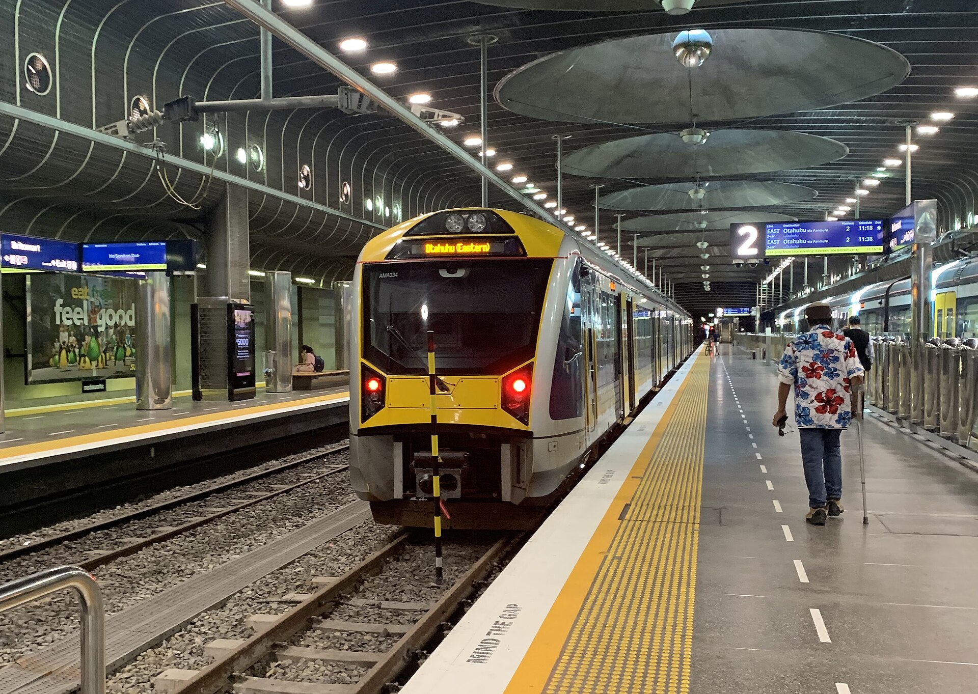
The backbone since the CRL. Electric, reasonably frequent on weekdays, less so at weekends and in the evening — check the app rather than assuming. Stations useful to visitors include Britomart, Te Waihorotiu, Karanga-a-Hape, Maungawhau, Newmarket, Parnell, Kingsland (for Eden Park) and Puhinui (for the airport bus). See the trains guide.
Ferries
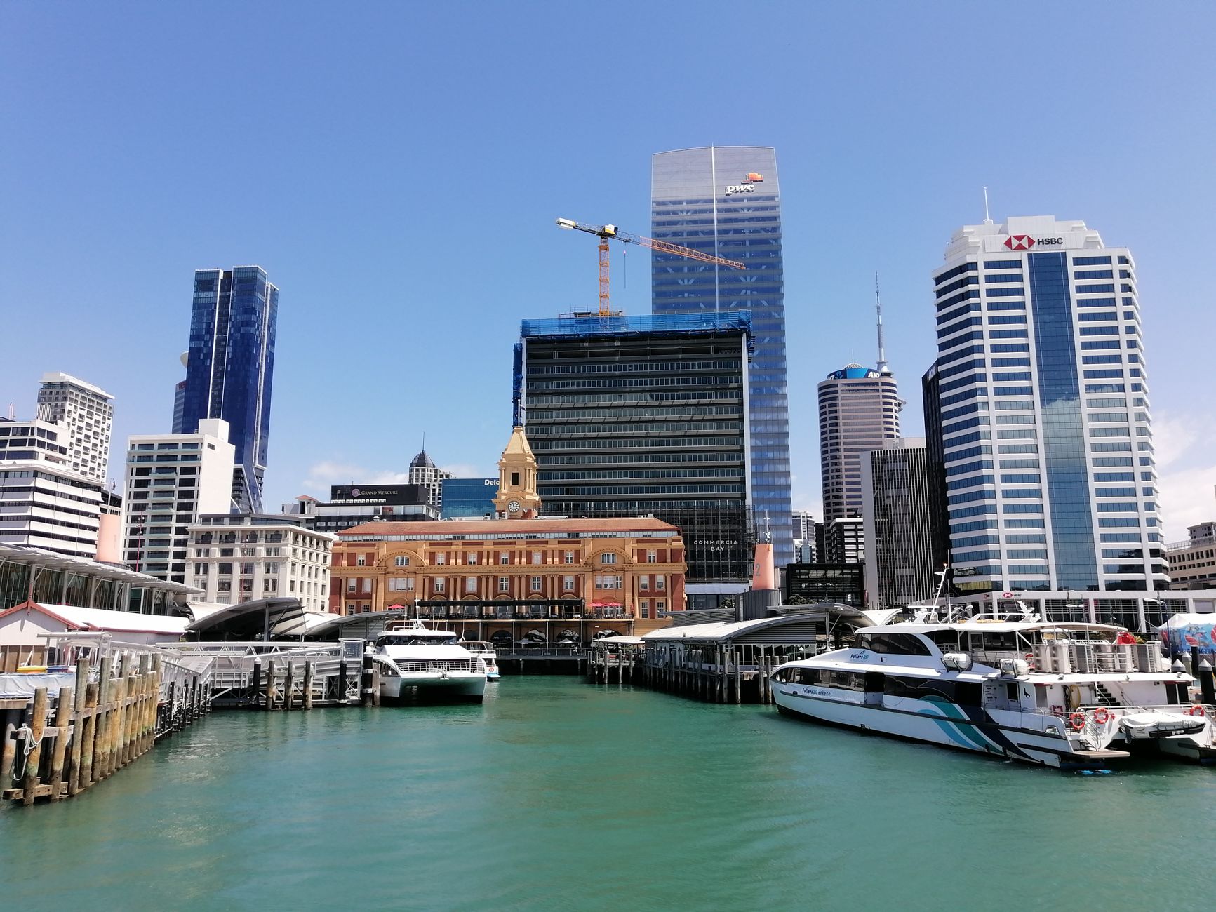
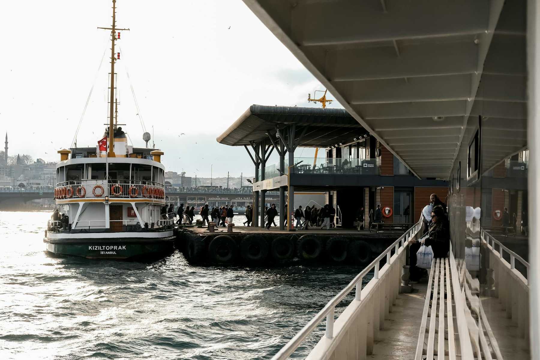
Not a fallback — the main event. Ferries from the Downtown Ferry Terminal on Quay Street reach Devonport in about twelve minutes, Waiheke in about forty on the Fullers360 fast service, and Half Moon Bay, Birkenhead, Bayswater and Hobsonville among others. The Tiritiri Matangi service is Explore Group from Viaduct Harbour, not Fullers from Downtown, which catches people out constantly. SeaLink’s car ferries run from Wynyard Quarter and Half Moon Bay, and go to Great Barrier as well as Waiheke.
Arriving anywhere by water in Auckland is straightforwardly better than arriving by road. See the ferry routes and schedules guide, and check the departure wharf rather than assuming they all leave from one place.
Buses
The network that fills the gaps — Ponsonby, Mission Bay and Tāmaki Drive, the Zoo, Kelly Tarlton’s, the airport link. Frequent on the main corridors, thin on the edges, and subject to the same traffic as everything else. The bus guide has the routes worth knowing.
Walking and cycling
Central Auckland is more walkable than its reputation suggests, though hillier — the isthmus is a volcanic field, and the gradients are real. The waterfront from Britomart to Wynyard Quarter is flat and continuous; Tāmaki Drive east to Mission Bay is flat, has a cycleway, and is one of the best urban walks or rides in the country.
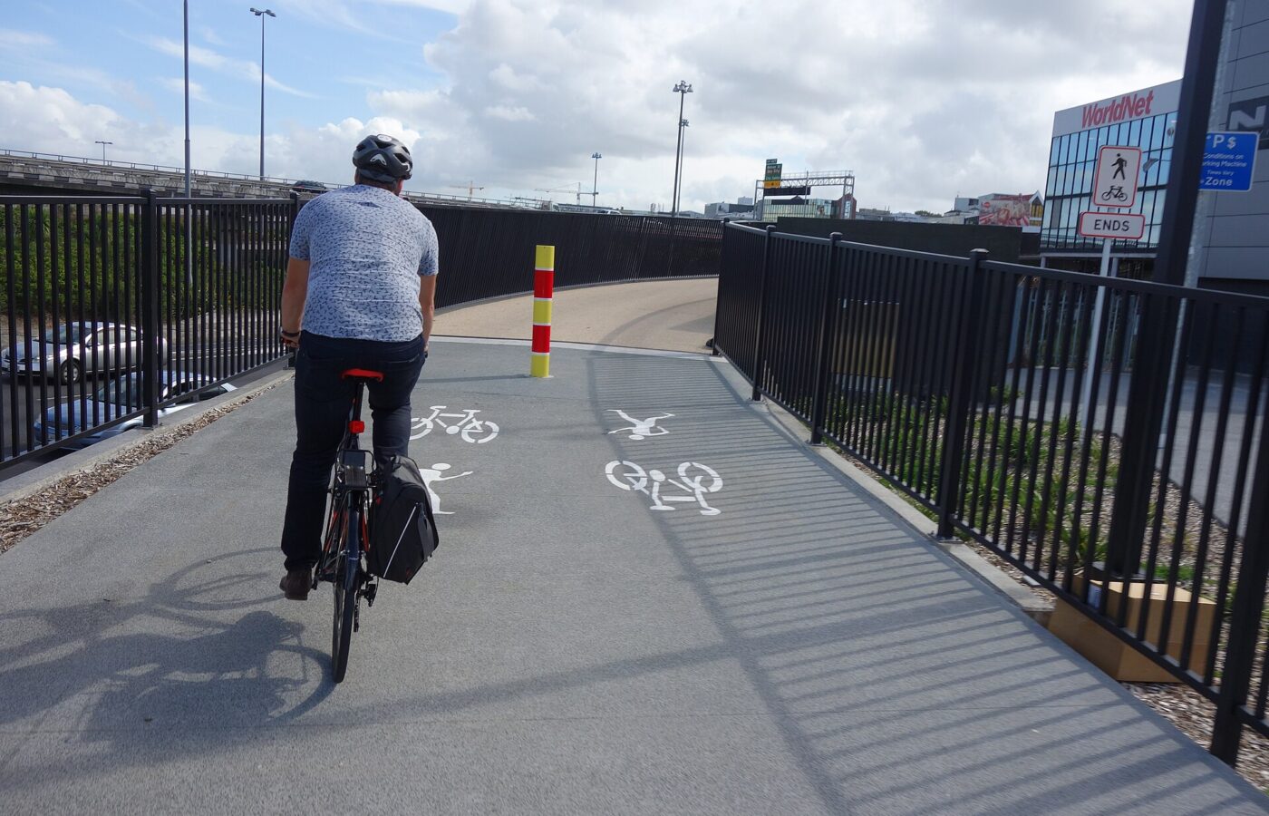
The separated cycle network is patchy overall but the central sections are good, including the Nelson Street cycleway and the Northwestern route. Bike hire and e-scooters are widely available. Helmets are compulsory by law for cyclists in New Zealand and this is enforced. See the cycling guide.
Fares and how to pay
- AT HOP card is the standard fare card, and there is a card fee to buy one. Contactless bank cards and phones are also accepted on most services — simpler for a short visit, though check whether it gets you the same fare.
- Fares are zone-based. They moved during 2026, so check current values on at.govt.nz. A day inside the central zones is inexpensive; the airport is a three-zone journey.
- Tap on and tap off. Forgetting to tap off charges you the maximum fare for that journey.
- Transfers within a set window are treated as one journey rather than two fares, which makes bus-to-train combinations far less painful than they look.
- The AT Mobile app and its Journey Planner are the reliable source for departures, and both reflect the post-CRL network.
- Ferries to Waiheke and Tiritiri Matangi are commercial services with their own fares — the Tiritiri crossing runs around NZ$110; confirm before booking.
The public transport guide covers the mechanics in full, and getting around Auckland compares the modes.
A three-day car-free itinerary
Day one: on foot
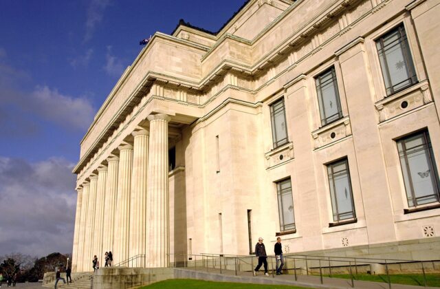
Breakfast in Britomart, then the waterfront walk west past the 1912 Ferry Building and the Viaduct to Wynyard Quarter — flat, continuous, fifteen minutes without stopping. Turn inland through Albert Park to the Art Gallery, free for the permanent collection, then uphill to the Domain and the Auckland War Memorial Museum. That is a full day and you have not used a vehicle.
Evening: train one stop to Karanga-a-Hape for K Road, or walk fifteen minutes to Ponsonby.
Day two: on the water
A gulf island, which is car-free by definition. Waiheke has a bus network that meets the ferries and covers the beaches and most cellar doors — you do not need a rental car there, and if you intend to taste wine you should not have one. Rangitoto has no vehicles at all beyond the operator’s own. Tiritiri Matangi is a walking island.
Alternatively, the cheap version: the twelve-minute crossing to Devonport, the fifteen-minute walk up Mount Victoria / Takarunga, North Head next door, and a bus onward to Takapuna for the beach.
Day three: cones and coast
Train to Maungawhau station and walk up Maungawhau / Mount Eden — the summit road is closed to general vehicles anyway, so a driver would be walking the same last stretch you are. Come back down into Mount Eden village for lunch.
Afternoon: bus east along Tāmaki Drive to Mission Bay, or walk or cycle the whole way — it is flat, coastal and about eight kilometres. Kelly Tarlton’s is on the same road if you want an indoor option.
This is very close to the itinerary a driver would follow, minus the parking. Compare it with our standard three-day plan and you will see the only real substitution is the west coast.
The honest limits: what you cannot reach
This is the section most car-free guides skip, and it matters.
The west coast beaches
Piha, Karekare and Bethells have no useful public transport. There is no bus you can rely on, the roads are winding, and a taxi or rideshare each way is expensive and hard to arrange for the return leg — do not assume you will get a ride back from Piha on a weekday afternoon.
Your options: a guided tour from the city, which is the realistic answer and there are several; or a one-day car hire, which is what we would suggest if the coast matters to you. Renting for a single day is far cheaper than paying central parking for a week, and you can pick up and drop off without ever driving in the city centre if you plan it.
Muriwai’s gannet colony
Same problem, further out. The colony is genuinely extraordinary between roughly August and March, and it is tour-or-car.
Matakana and Goat Island
An hour or more north, and not served by anything you would want to rely on. Matakana tours run from the city.
The Waitākere Ranges
Even with a car, check the Auckland Council track status page before you go — Goldie Bush and Te Henga are among several tracks closed for kauri dieback control and storm damage, and the list changes.
What to substitute instead
- For dramatic coastline: the coastal walks around the North Shore headlands and the eastern bays are bus-served, flat and genuinely good.
- For a wild beach: Rangitoto’s lava coast, or the far end of Waiheke, both reachable by ferry.
- For rainforest: the Domain’s mature bush, or the walking tracks on Motutapu and Waiheke.
- For a serious walk: the hikes and walking trails guide flags which routes are reachable on public transport.
Getting to and from the airport
Entirely doable, and the cheapest of the options is also the most reliable.
- AirportLink bus to Puhinui station, then train. The orange AT bus runs every ten minutes, roughly 4:30am to 12:40am, seven days. Puhinui to the domestic terminal is 13-17 minutes and to international 18-20. Airport to the city centre is a three-zone journey, about NZ$6.50 adult on AT HOP or contactless. It is immune to motorway traffic, which is its real advantage.
- Rideshare and taxis — Uber, Bolt and DiDi all serve the airport: Uber has dedicated pick-up zones, while Bolt and DiDi use the Rideshare (Other) zones. Note that Ola left New Zealand in 2024 and Zoomy is now YourRide, so ignore older lists.
- The two terminals are still separate buildings, linked by a free shuttle roughly every fifteen minutes or a signposted ten-minute green-line walk. Allow more than the stated time; construction keeps rerouting it.
See the airport to city guide and the terminal transfer guide.
Where to stay if you are not driving
Base matters far more without a car, because a poor one costs you a fixed hour every day.
- City centre — Britomart, the Viaduct, the top of Queen Street. Walking distance to the ferry terminal and on the train network. The obvious choice.
- Ponsonby or Parnell. More character, ten to fifteen minutes in, and both well served by buses. Ponsonby in particular means you can walk home from dinner.
- Newmarket or Mount Eden. On the train network, cheaper, and genuinely convenient since the CRL.
- Devonport. Lovely, and every journey includes a ferry — charming for two days, mildly limiting for five, and the last sailings are earlier than you might expect.
- Avoid the airport area and outer suburbs unless there is a specific reason. Without a car they are a long way from everything.
See the best areas to stay and where to stay in Auckland.
Car-free with children, or with limited mobility
With children
Better than driving, in several respects. Ferries are an activity rather than a journey at that age, trains are a novelty, and you are not fighting over car seats and parking. The practical constraints: pushchairs are fine on trains and ferries and awkward on a busy bus, and the walk up a cone is a real walk. See Auckland with kids and with toddlers.
With limited mobility
The network is broadly accessible — the new CRL stations are step-free, the main ferry terminals have level boarding, and buses kneel. The constraints are Auckland’s topography rather than its transport: the city centre is hilly, and the volcanic cones are steep with no vehicle access to the summits.
The flat, rewarding options: the waterfront from Britomart to Wynyard, Tāmaki Drive to Mission Bay, the Devonport village front, the lower reaches of Cornwall Park, and the Domain around the Wintergardens. That is a genuinely good several days without a hill in it.
When you should hire a car anyway
We would rather be useful than dogmatic. Hire one if:
- The west coast is a priority. One day, collected in the morning and returned that evening.
- You are going north to Matakana, Goat Island or the Bay of Islands.
- You are continuing on a road trip — in which case collect the car on the morning you leave Auckland, not the day you arrive.
- You are travelling with several people and a lot of luggage to somewhere off the network.
What we would not do is hire for the whole stay. Petrol has run above NZ$3 a litre through 2026, central parking is expensive, and Auckland’s one-way system is unfriendly to people who do not already know it. See the car rental guide, the parking guide and, if you are driving, our guide to driving here — New Zealand drives on the left and the road rules have some genuine local specifics.
What car-free costs
| Item | Rough cost |
|---|---|
| AT HOP card | One-off card fee; check current |
| A day of central-zone travel | A few dollars — confirm at at.govt.nz |
| Airport to city, each way | ~NZ$6.50 on AT HOP |
| Devonport ferry return | Modest; check current fare |
| Waiheke fast ferry return | Commercial fare — check Fullers360 |
| Tiritiri Matangi return | ~NZ$110 — confirm before booking |
| One day of car hire, incl. fuel | NZ$90-150 |
Against that, a week of car hire plus central parking runs into several hundred dollars for a vehicle that would sit still for most of it. The budget guide has the full picture.
Frequently asked questions
Can you visit Auckland without a car?
Yes, comfortably. The city centre, the inner suburbs, the volcanic cones, Devonport, the eastern bays and every Hauraki Gulf island are all reachable on trains, buses, ferries and on foot. The only significant gap is the west coast — Piha, Karekare, Bethells and Muriwai — which needs a tour or a one-day car hire.
Do I need a car in Auckland as a tourist?
Not for a typical city visit, and having one for the whole stay is usually a net negative — central parking is expensive and the one-way system is unhelpful. The best approach for most visitors is car-free by default, with a single day of hire if the west coast matters.
Has the City Rail Link made Auckland easier without a car?
Substantially. It opened on 13 September 2026 with three new underground stations — Te Waihorotiu on Queen Street, Karanga-a-Hape for K Road, and Maungawhau at Uptown — and turned Britomart into a through station. The city centre effectively has a metro now, which puts the inner suburbs within easy reach of the waterfront.
How do I get from Auckland Airport to the city without a car?
Take the AirportLink bus to Puhinui station, then the train. The bus runs every ten minutes from about 4:30am to 12:40am, seven days, and the whole journey is a three-zone fare of roughly NZ$6.50 on AT HOP or contactless. It avoids motorway traffic entirely, which matters if you have a flight to catch.
Can I get to Piha without a car?
Not reliably. There is no useful public transport, and arranging a rideshare for the return journey from Piha is difficult. Take a guided tour from the city, or hire a car for that single day.
Do I need a car on Waiheke Island?
No. Buses meet the ferries and cover the beaches and most cellar doors, and there are hop-on-hop-off tours if you would rather not read a timetable. If you intend to taste wine you should not be driving anyway — New Zealand’s enforcement is serious and the island roads are narrow.
Is Auckland walkable?
The centre is, though it is hillier than visitors expect — the isthmus is a volcanic field and the gradients are real. The waterfront from Britomart to Wynyard Quarter is flat and continuous, and Tāmaki Drive east to Mission Bay is one of the best flat urban walks in New Zealand.
What is the AT HOP card and do I need one?
It is Auckland Transport’s fare card, used by tapping on and off; there is a fee to buy the card itself. Contactless bank cards and phones are accepted on most services too, which is simpler for a short visit. Fares are zone-based and moved during 2026, so check current values on at.govt.nz.
Can I do a day trip to Hobbiton or Waitomo without a car?
Yes — coach tours run from central Auckland and pick up from city hotels. They are ten to thirteen hours door to door, so treat one as a whole day and do not schedule it the day before a flight.
Related Auckland Guides
- Auckland itineraries: how to plan your days
- Auckland public transport explained
- The Auckland trains guide
- Auckland ferry routes and schedules
- Getting around Auckland
- Cycling in Auckland
- Auckland Airport to the city centre
- 3 days in Auckland: the complete itinerary
Photo Credits
An AM class train at Waitematā Station (Britomart): AM Class train at Britomart Station by SageWikiPro, CC BY-SA 4.0, via Wikimedia Commons.
The Nelson Street cycleway: Nelson Street Cycleway 021 by Schwede66, CC BY-SA 4.0, via Wikimedia Commons.